


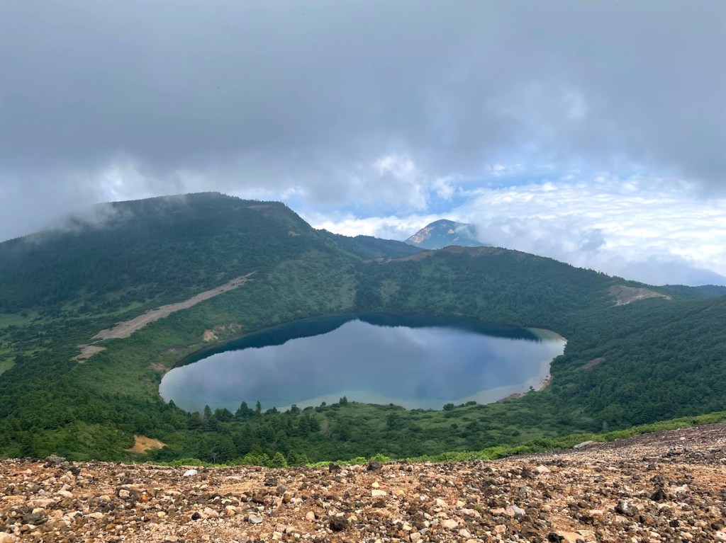
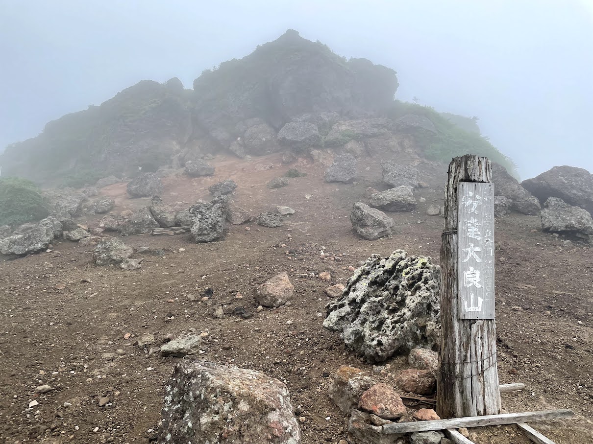
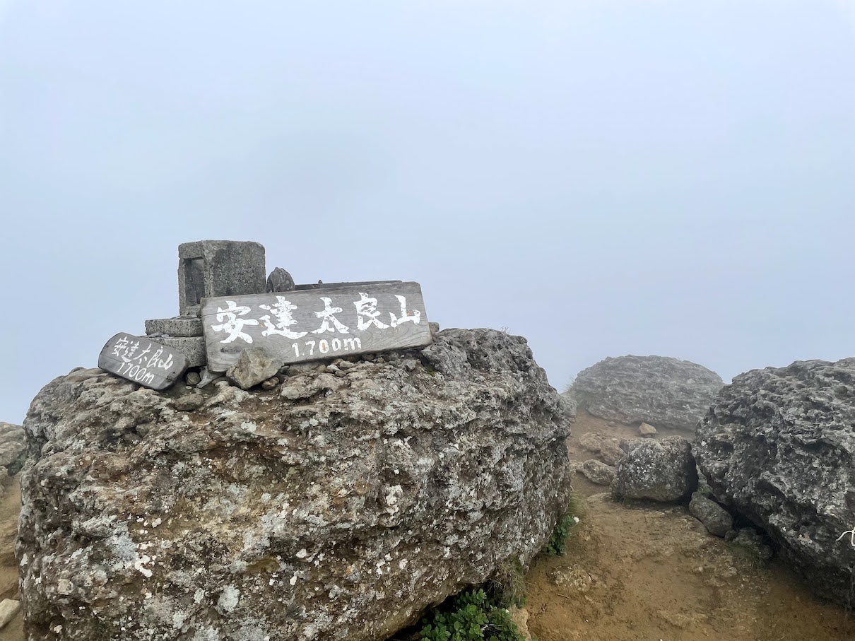
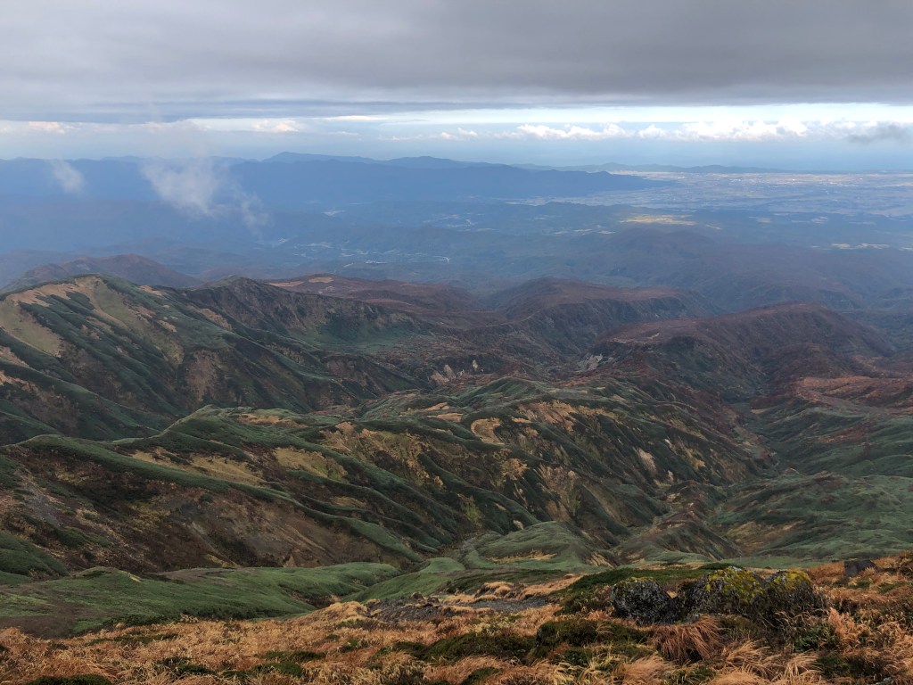
Im Winter ein beliebtes Skigebiet, in allen anderen Jahreszeiten ein Mekka fuer Meizanologen (das Wort gibt es nicht wirklich). Der Adatara-yama ist eine weitere Bergperle mitten in Honshu. Wenn man in der Gegend um Fukushima/Koriyama/Inawashiro/Aizu ist, wuerde ich definitiv ueber einen Abstecher nachdenken. Der Adatara-yama ist ein aktiver Schichtvulkan, it eindrucksvollem grossem Krater.
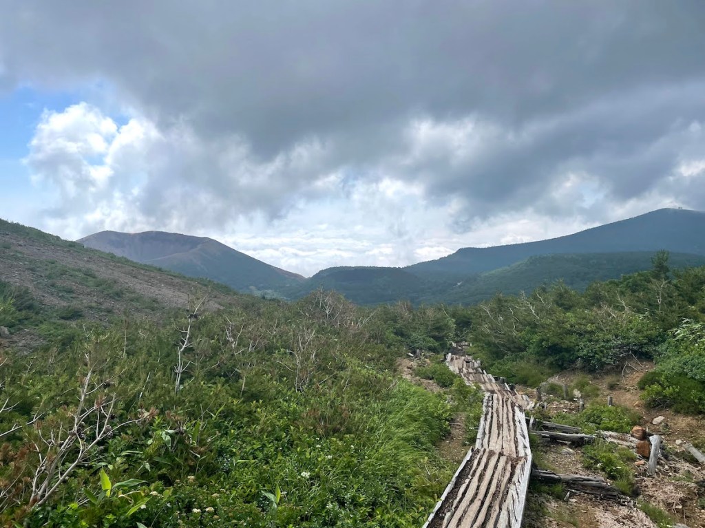
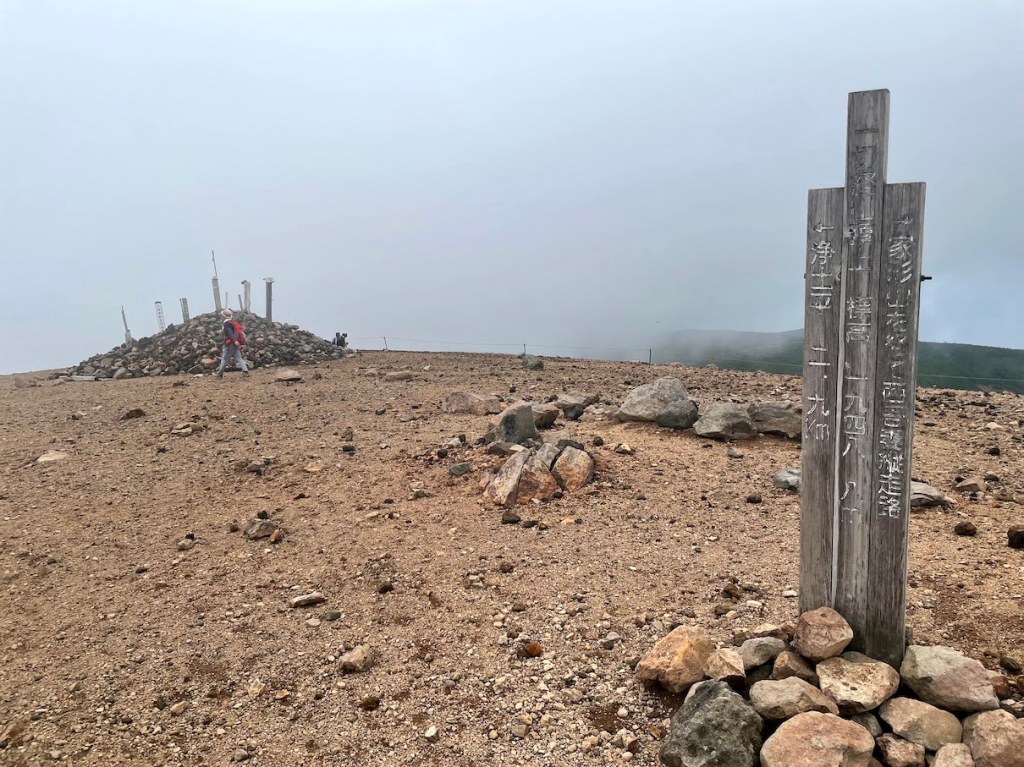
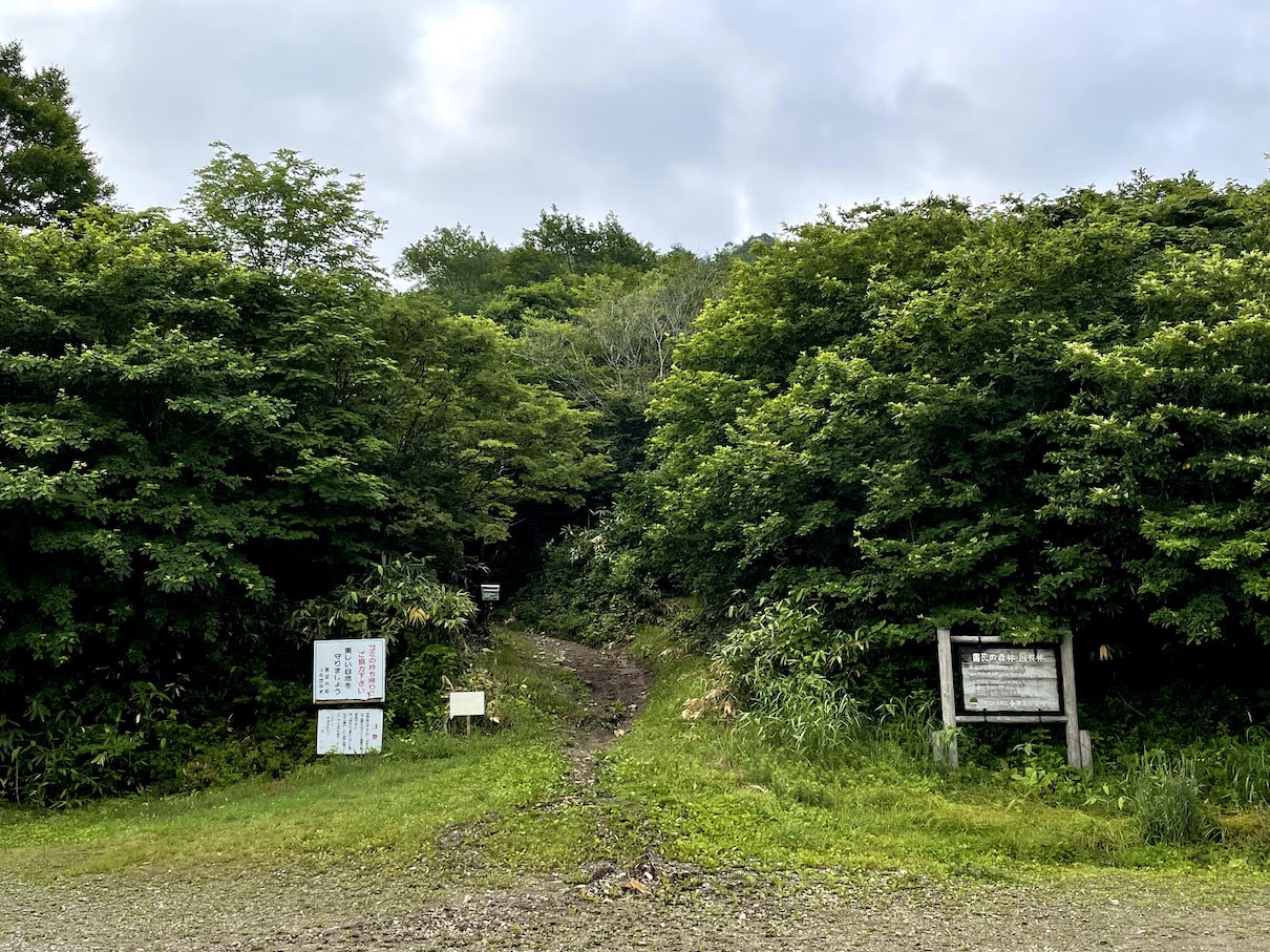
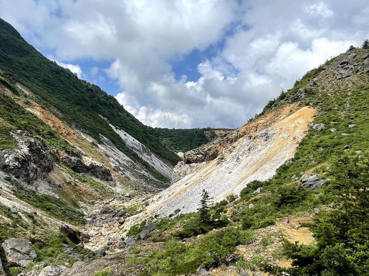
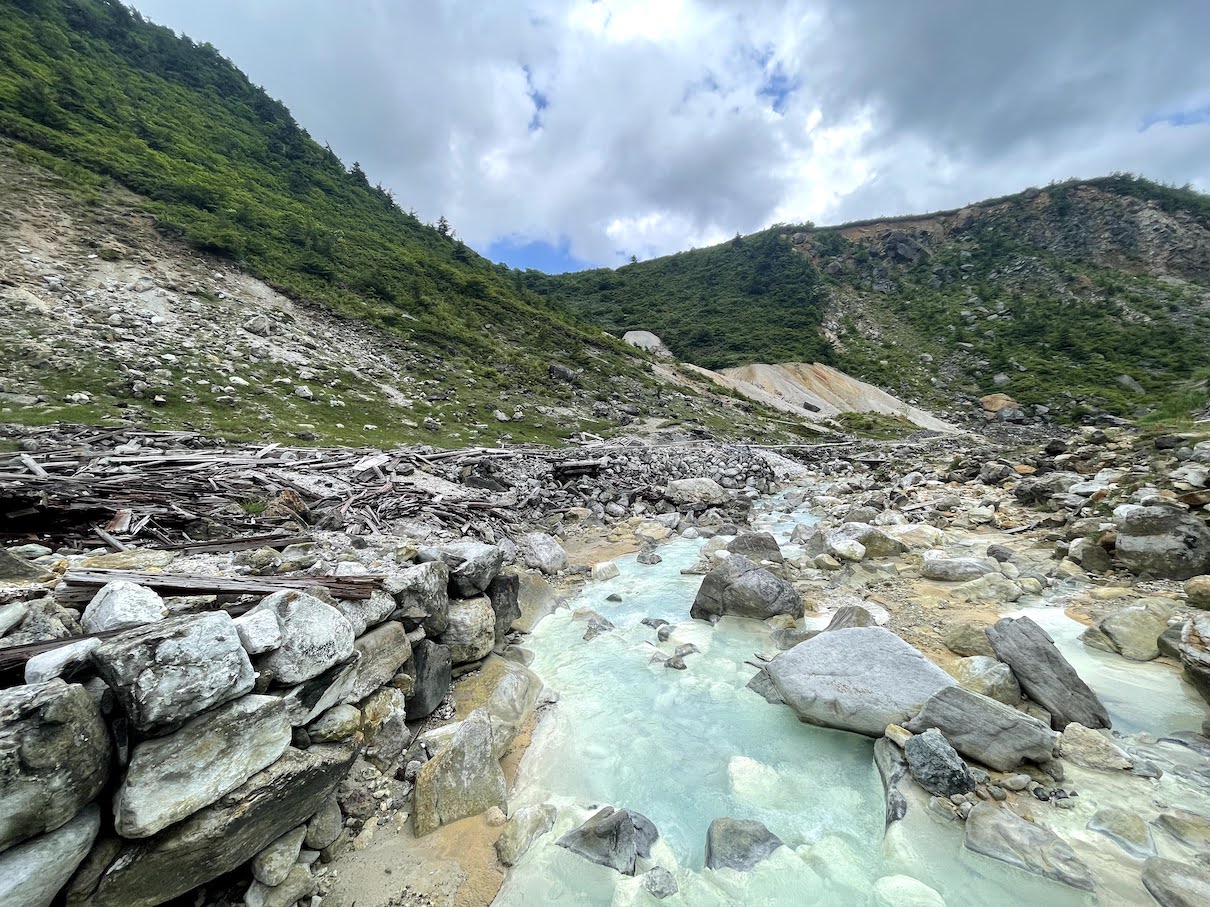
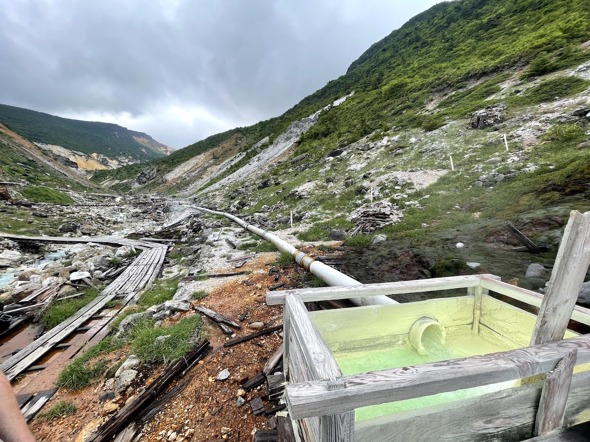
Es gibt mehrere Routen nach oben. Wir entschieden uns die Route vom Numajiri-tozanguchi 沼尻登山口 zu nehmen. Numajiri ist ein beliebtes Skigebiet und der Wanderweg beginnt ein bisschen weiter ueber der Skipiste. Fuer die Anreise braucht man ein Auto. Man faehrt zunaechst an das Skigebiet, folgt dann einer nicht gut ausgebauten Strasse entlang des Skiliftes und faehrt quasi die ganze Piste nach oben. Am Ende des Liftes (und Ende der Skipiste) geht es noch eine kurze Strecke weiter ueber die holprige Strasse bis man schliesslich den Parkplatz am Eingang erreicht. Von dort aus ist es ein ca. 5h loop Hike hoch zum Adatara-yama Hauptgipfel, ueber den Tetsuzan (dem hoechsten Punkt des Gebirges), vorbei an der Emergency Hut und schliesslich vorbei an einem Schwefelback wieder zurueck zum Parkplatz.
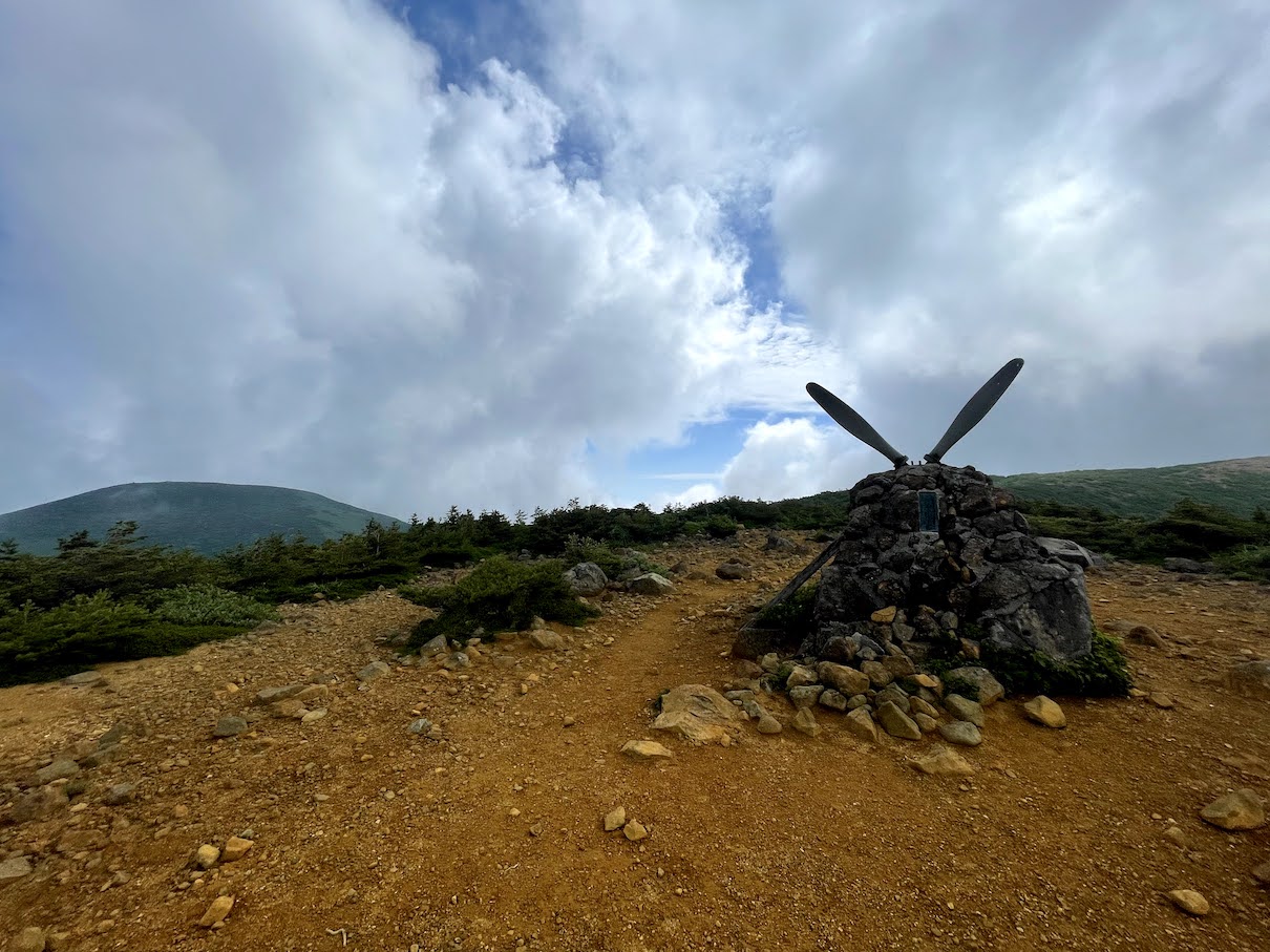
Auf dem Weg Zurueck zum Numajiri Trailhead 沼尻登山口 kommt man an einem Gedenkstein vorbei aus dem 2 Propeller ragen. Der sogenannte Shakunage Turm 石楠花の塔 soll an den Hubschrauberabsturz an der Stelle der japanischen Selbstverteidigungsstreitkraefte aus dem Jahr Showa 33 (1958) erinnern.
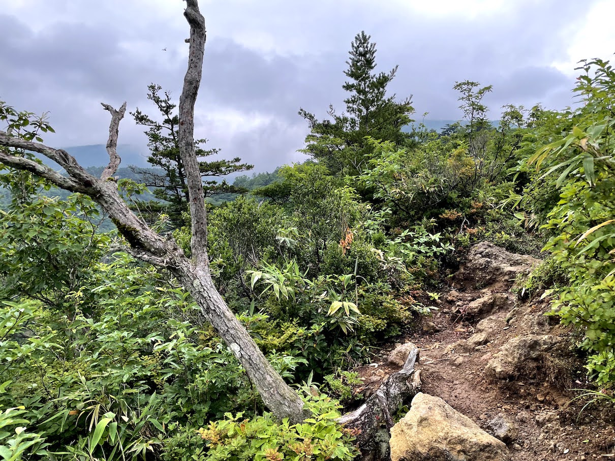
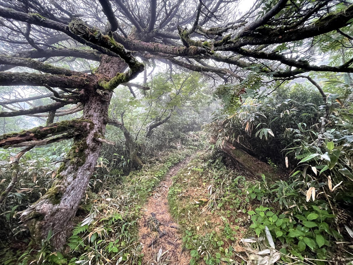
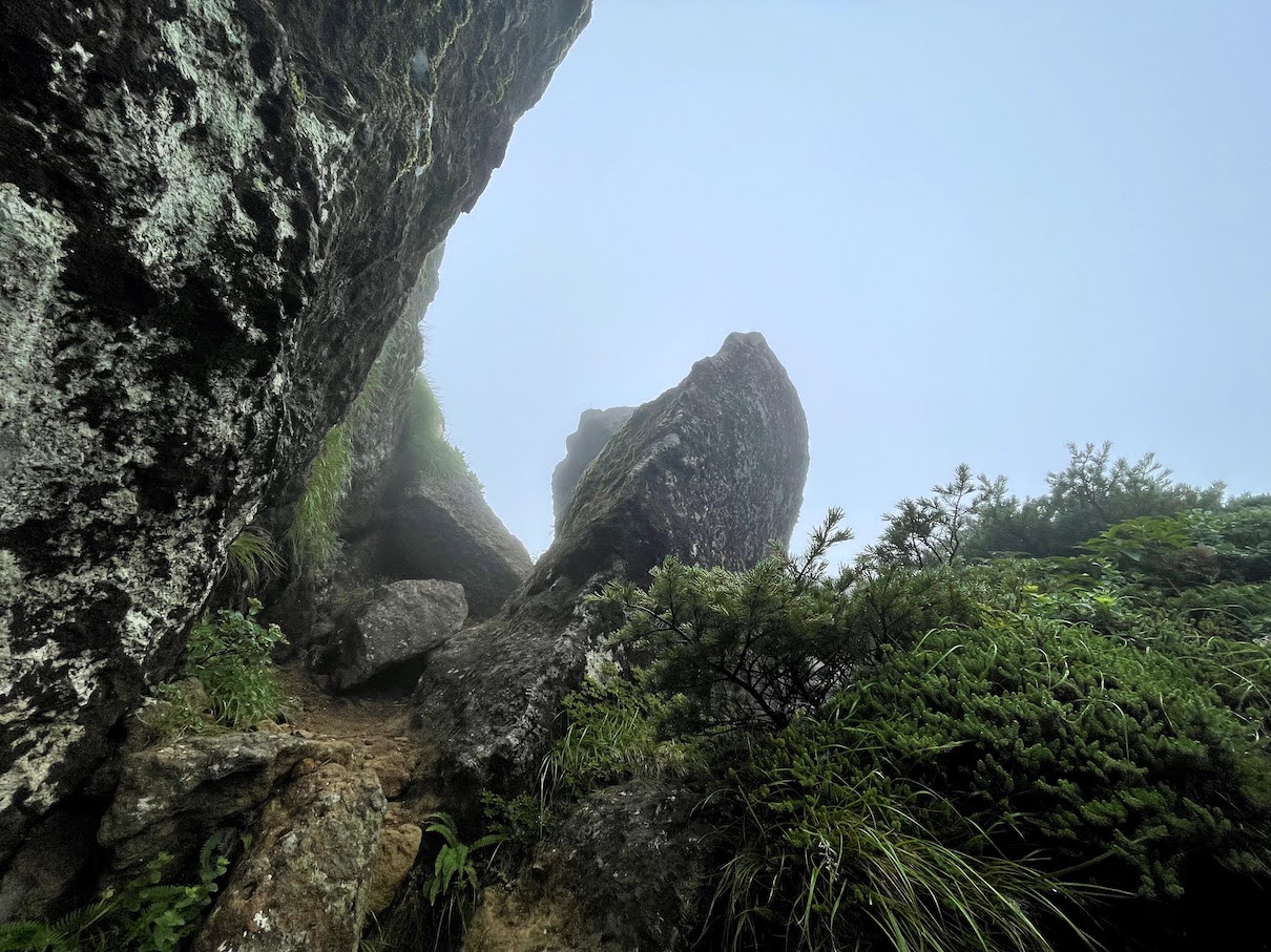
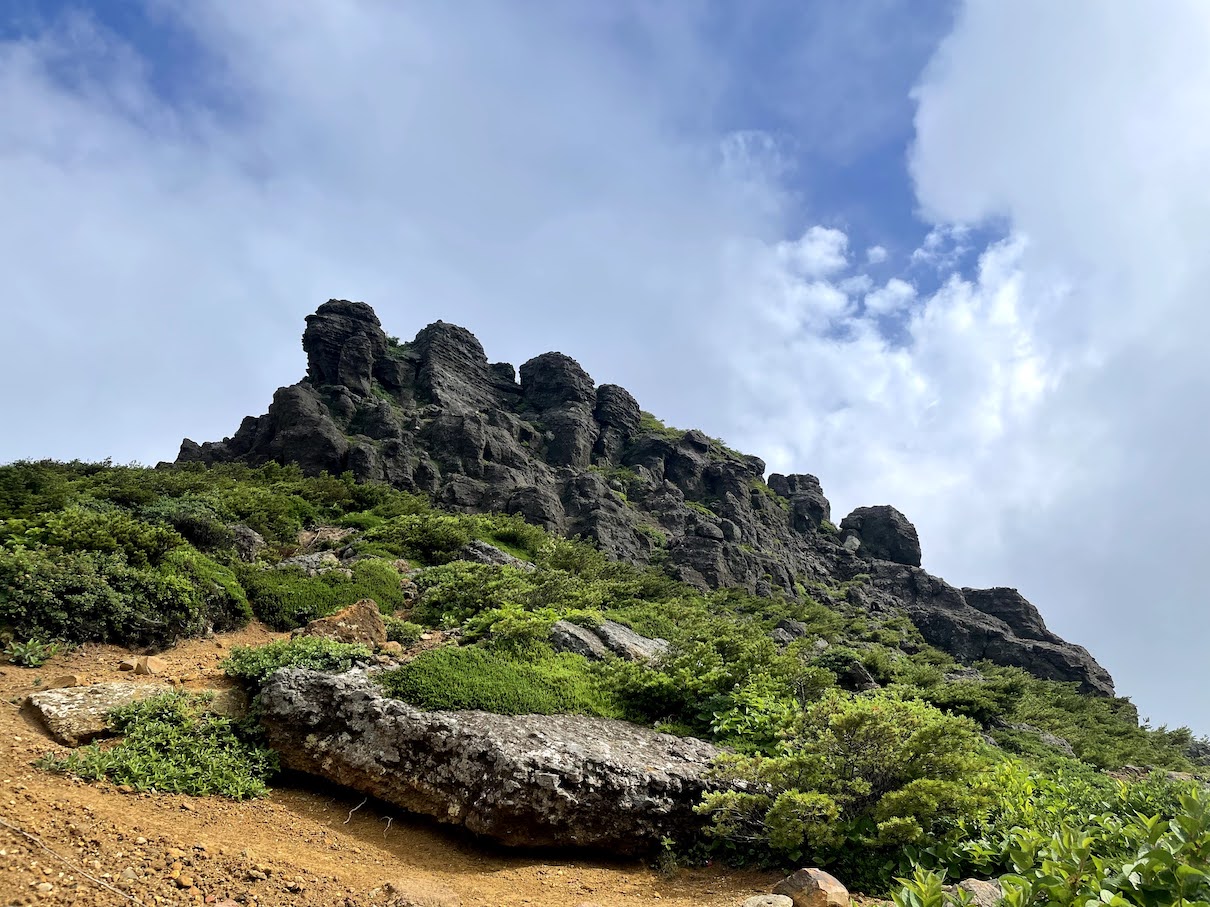
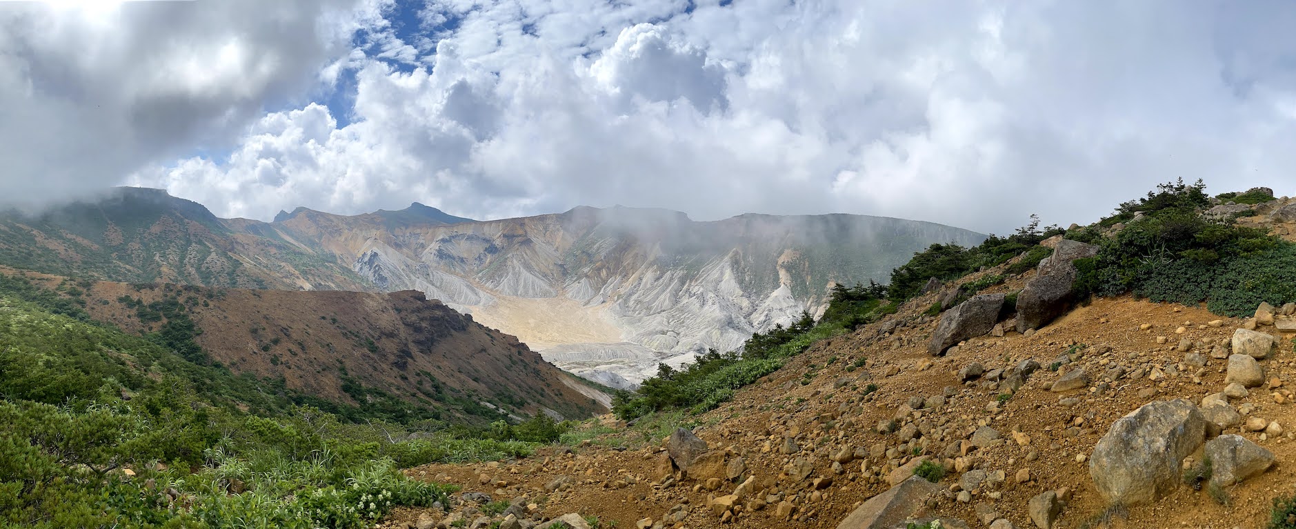
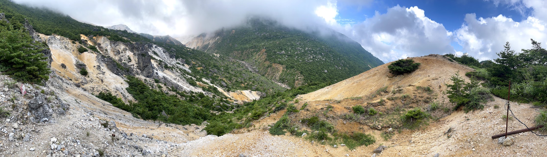
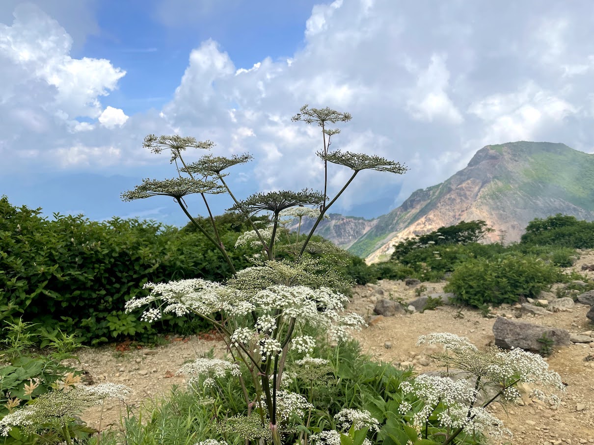
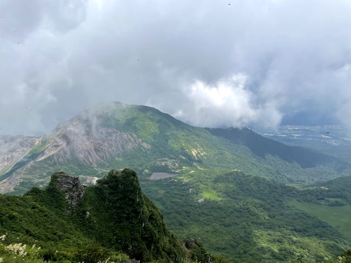
Alles in allem ein mittlerer Hike. Besteigt man zunaechst noch durch dichte Waelder, erreicht man nach 1-1.5h den Vulkankrater, an dem sich die Landschaft stark veraendert und man durch die fuer Vulkane typische marsaehnliche Landschaft wandert. An guten Tagen hat man eine wunderbare Aussicht in das Tal sowie in den Adatara-yama Krater.


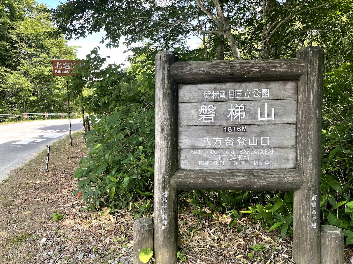
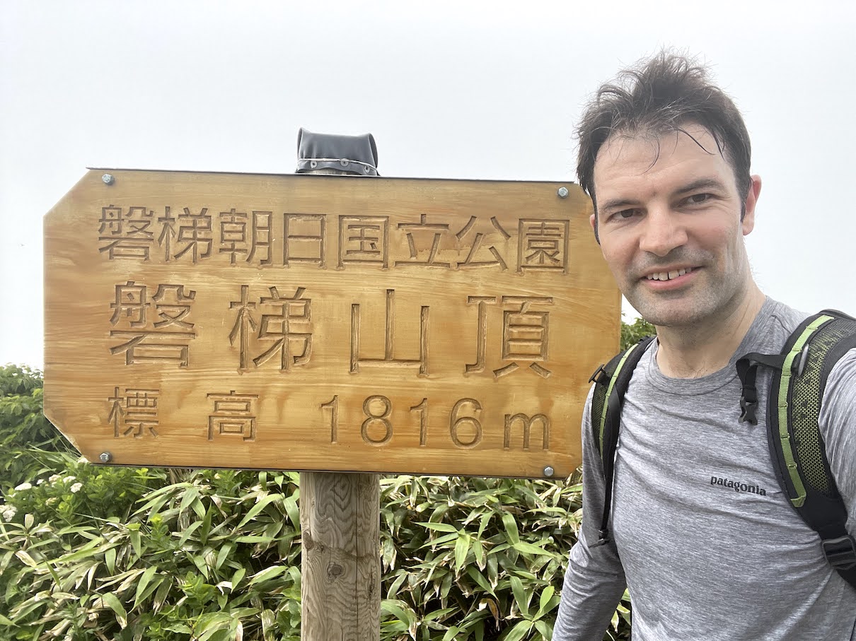
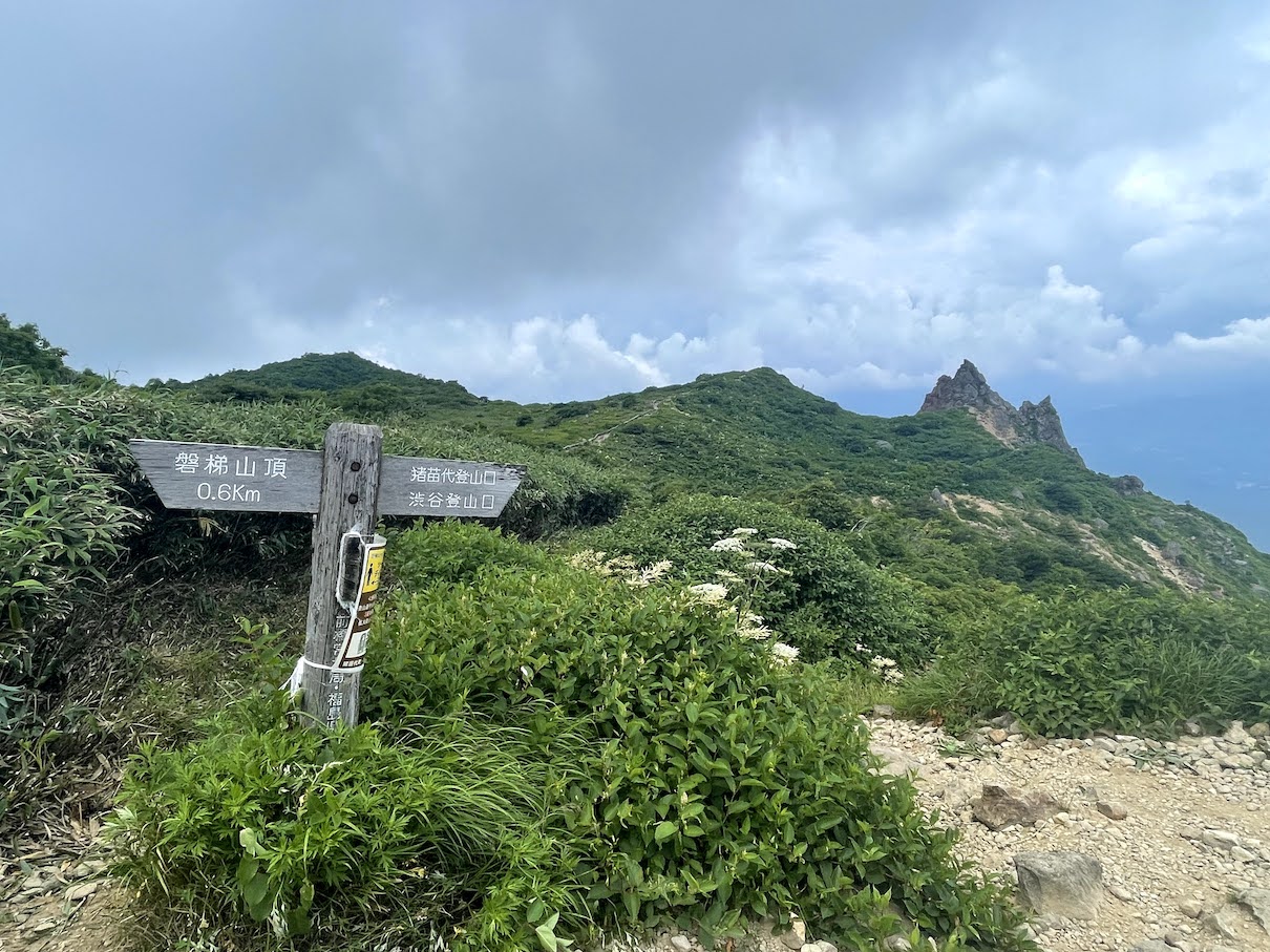
Der Bandai-san 磐梯山 ist ein prominenter Schichtvulkan im Norden des Inawashiro Sees 猪苗代湖 in der Praefektur Fukushima. Der Vulkan ist im Jahr 1888 relativ stark ausgebrochen, was die Form des Berges sehr stark veraendert hat und den heutigen Teil Ura-Bandai 裏磐梯 geformt hat. Davor hatte der Bandai-san eine aehnlich zylindrische Form wie der Fuji, woher er auch den Beinamen Aizu-Fuji 会津富士 bekam. Aizu-Wakamatsu 会津若松, oder manchmal auch nur Aizu 会津 genannt ist eine alte traditionelle Stadt westlich des Inawashiro Sees. Wer mehr ueber den Berg und die Eruption Ende des 19ten Jahrhunderts erfahren moechte, dem sei ein Besuch im lokalen Bandai Vulkan Museum angeraten. Das japanische Wetteramt hat auch sehr interessante Informationen zum Bandai-san auf ihrer Website (auf Englisch)
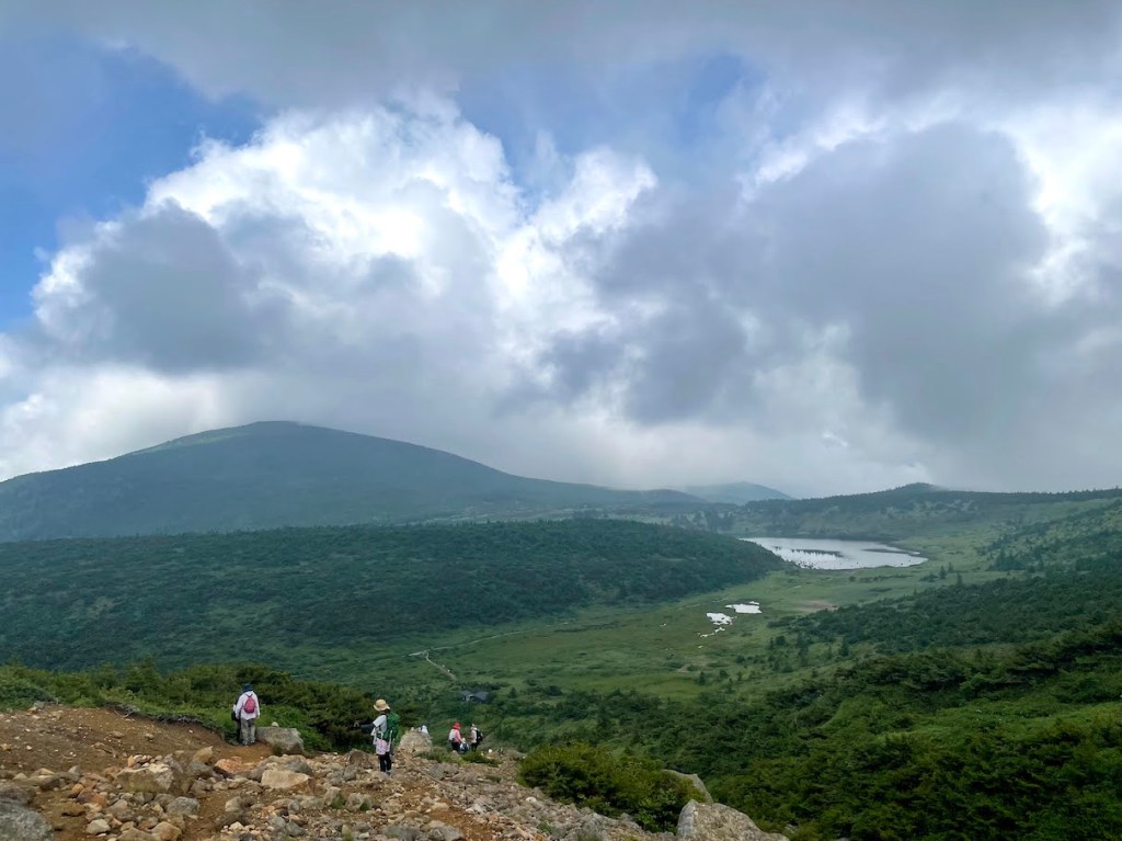
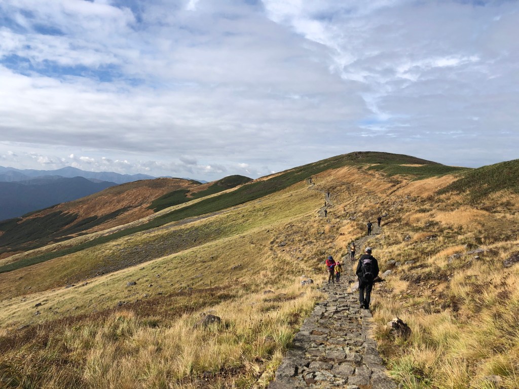
Es gibt mehrere Routen auf den Berg. Die einfachste und wohl beliebteste Route startet am Happodai 八方台登山口, welches sich direkt mittig der sogenannten Gold-Line ゴールドライン befindet, eine Bergstrasse die von Sueden nach Ura-Bandai fuehrt. Beim Happodai Eingang befindet sich ein relativ grosser Parkplatz, es sei aber trotzdem jedem geraten, so frueh wie moeglich zu kommen. Da der Bandai-san auch unter den 100 beruehmten Bergen Japans zaehlt, ist er extrem beliebt als Wanderziel.
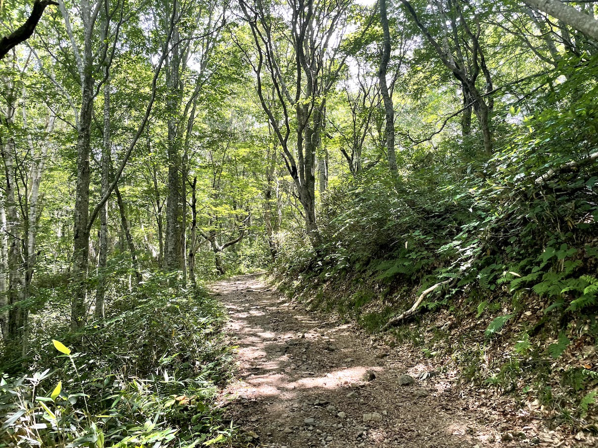
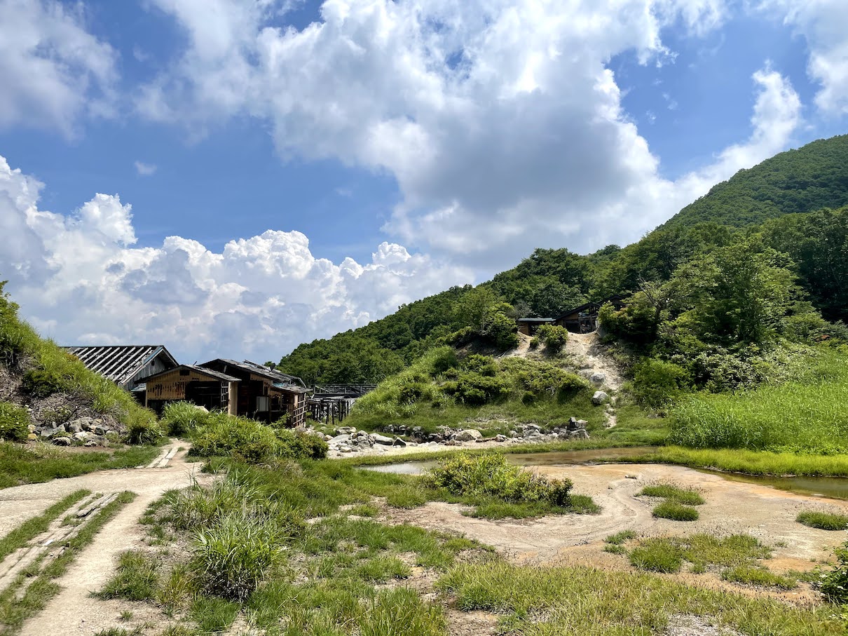
Der Hike an sich ist nicht allzu schwer und den Gipfel erreicht man in ca. 2 Stunden. Auf dem Weg passiert man eine alte verlassene Huette in der Naehe einer heissen Schwefelquelle 温泉, das Naka-no-yu 中の湯. Ca. 20 Minutem vor em Gipfel erreicht man ein Plateau von dem es eine Gute Aussucht auf das Umland gibt. Von dort aus sind es dann nur noch ca. 20. Minuten bis zum Gipfel. Der Gipfel an sich bietet ebenso eine freie Sicht auf das Umland.


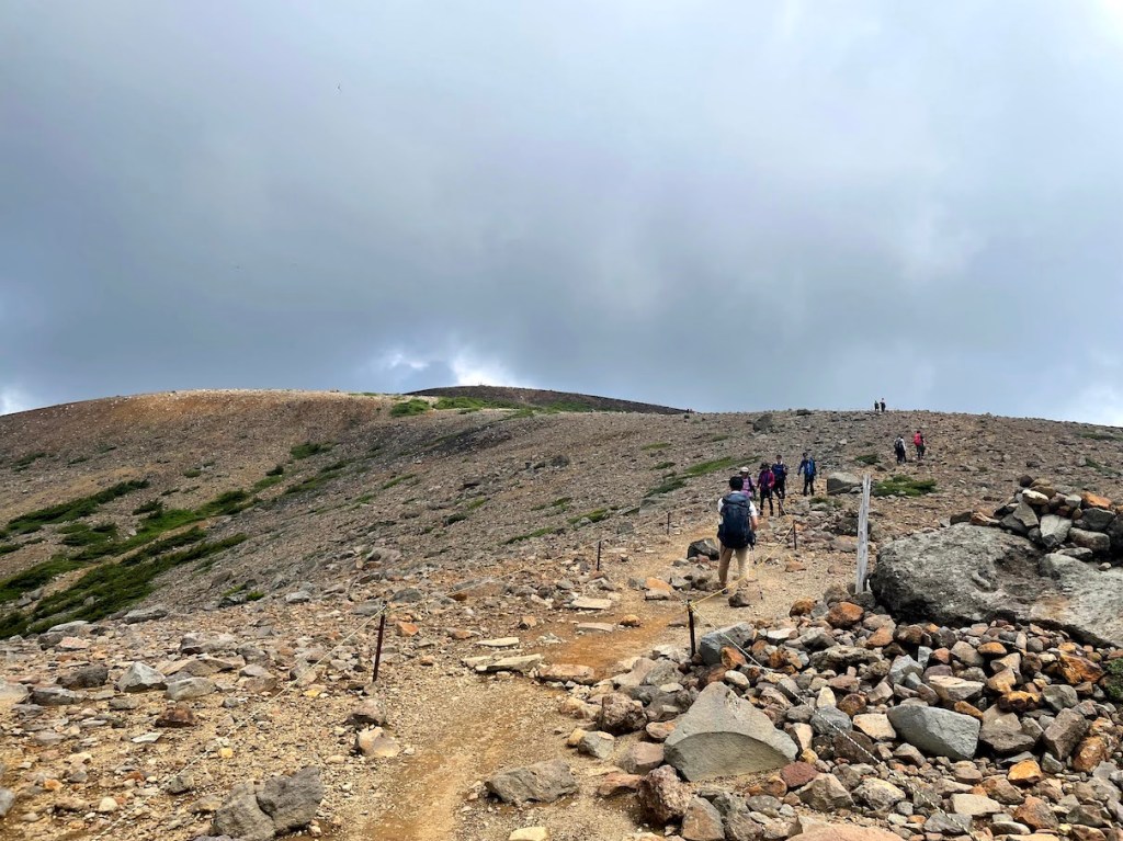
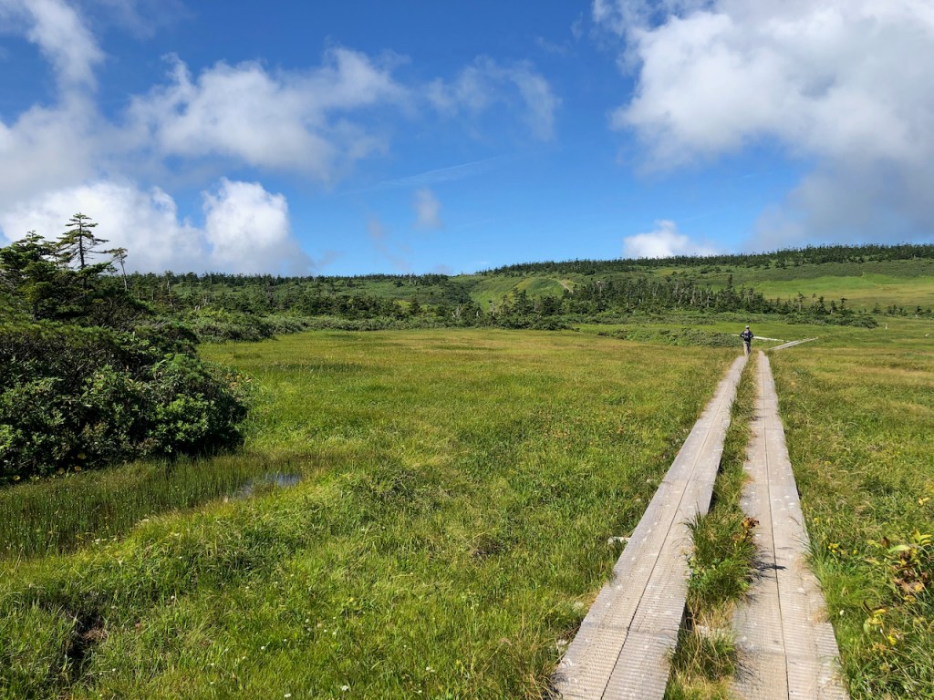
Netter Oktober Hike auf den Gassan. Der Berg ist ein beliebter Pilgerort in Japan, daher wuerde ich empfehlen ihn zu bestaeigen nachdem der Schrein oben auf dem Gipfel nicht mehr offen hat. Ich bin im Oktober 2020 hoch, als die Blaetter schon angefangen haben ihre Farbe zu wechseln. Selbst in dieser Zeit (der Schrein war schon geschlossen) und der beginnenden Kuehle oben auf dem Gipfel, waren noch sehr viele Leute unterwegs. Die meisten nehmen die Route ueber den Skilift, welcher erst um 8 Uhr morgens oeffne. Wenn moeglich wuerde ich daher empfehlen schon gegen spaetestens 6am morgens zu starten, um die Massen zu vermeiden. Die Gipfelmarkierung ist uebrigens nicht im Tempel, sondern kurz dahinter auf einer kleinen Anhoehe.
| Hoehe: | 1984m |
| Anfahrt: | Auto |


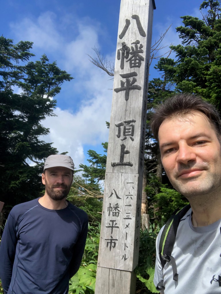
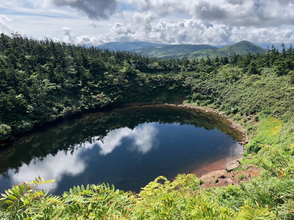
Der Hachimantai 八幡平 in der Provinz Iwate ist der wohl am einfachsten zu besteigende Hyakumeizan, wenn man mit dem Auto anreist. Der Parkplatz ist nur gut 100 Meter vor dem Gipfel und schon beim Aussteigen aus dem Auto bietet sich ein wunderbarer Anblick auf die Umgebung, inklusive dem Iwate-san. Die “Besteigung” des Hachimantai ist daher eher weiniger anstrengend und man findet sich schnell auf einem Rundgang ueber das sehr schoene Hochplateau.
| Hoehe: | 1613m |
| Anfahrt: | Auto |

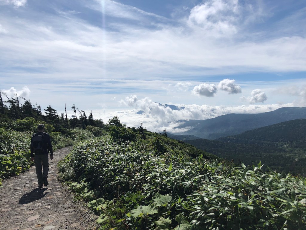

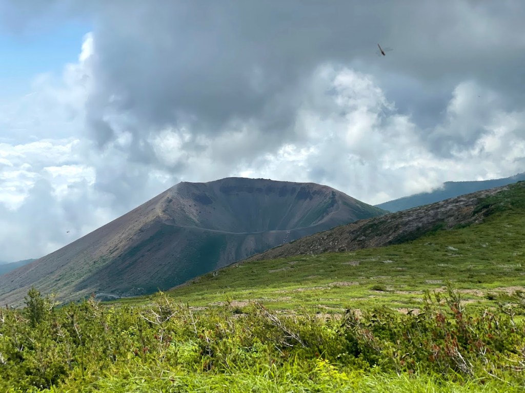
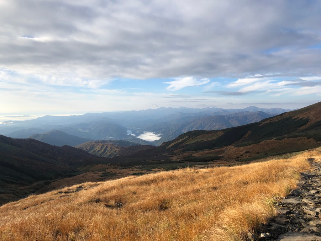
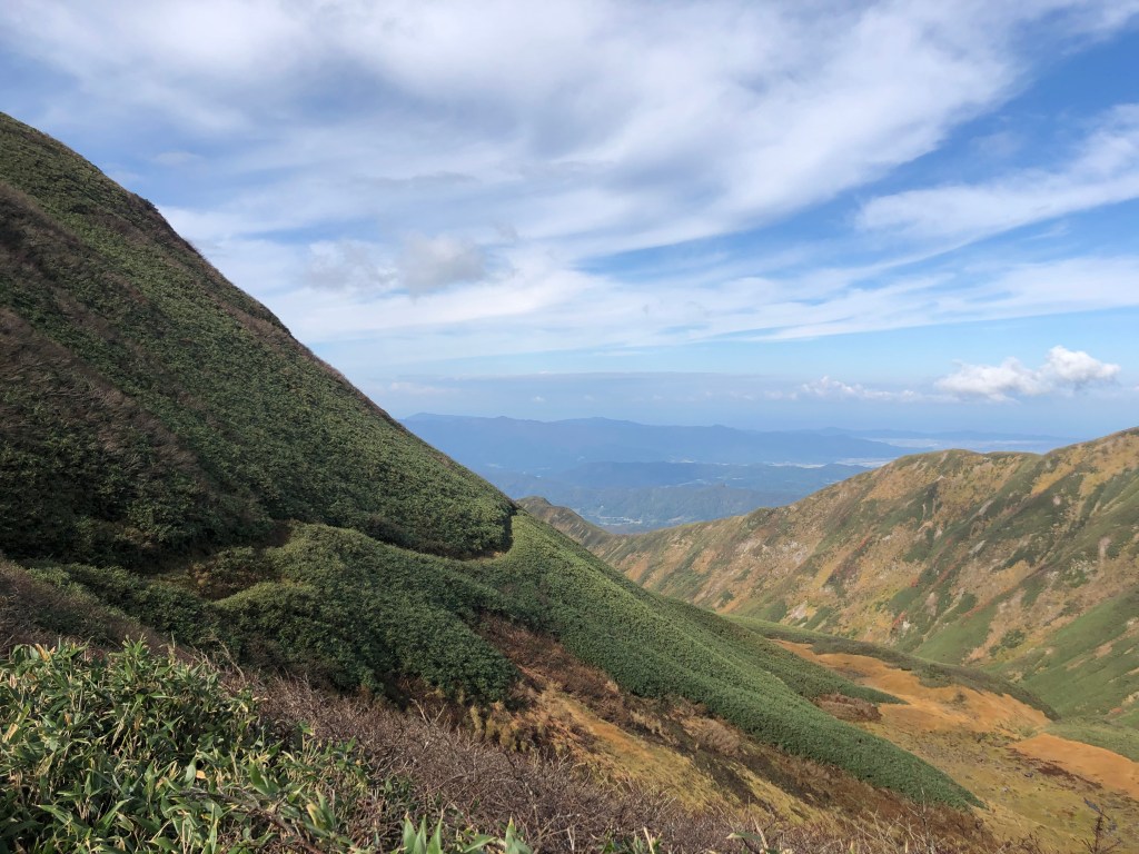
Der Iwate-san 岩手山 (oder auch Iwate-Fuji 岩手富士/Nanbu-Fuji 南部富士/Nanbukata-Fuji 南部片富士 genannt) ist ein imposanter Schichtvulkan, der ueber die Stadt Morioka wacht. Als relativ freistehender Vulkan und mit ueber 2000m Hoehe gehoert er auch zu den 21 Ultras in Japan. Ultras sind solche Berge/Vulkane, die eine topographische Prominenz von 1500 oder mehr haben, also solche die sich sehr stark in der Landschaft hervorheben. Der Anstieg ist nicht allzuschwer, aber sehr lange, da man von relativ weit unten anfaengt. Oben angekommen wird man jedoch mit der Marsaehnlichen Landschaft eines sehr schoenen Vulkankraters belohnt.
–
Iwate-san is one of Japan’s 21 Ultras and shares the same name the northern Japanese prefecture in where it is located. Iwate-san is located not far from the city of Morioka (the capital of Iwate prefecture) and due to its ultra prominent peak, can be seen from almost anywhere in the region. It is a majestic active volcano that watches over Morioka and the region. Iwate-san is also included in the list of 100 famous mountains compiled by mountaineer Kyuya Fukuda in 1964.
The hike can be approach by several trails outlined below. While all the trails lead to the summit in the end, there are a variety of reasons for people choosing a certain route. The Umagaeshi route is by far the most popular. Near the start of the Yakehashiri route, there is an impressing wide field of lava rock to be visited, and the Amihari route is the longest route that also starts and ends right at an Onsen area. When we approached the mountain in August 2020, we chose the Omisaka route, which starts at the Omisaka parking lot in the south. This route, while not being the most known, I felt it was a good choice since there were not many climbers on this path (I think I saw about a handful the whole time (except for when we reached the summit, of course) .This post and its description therefore focuses on the Omikasa-route.
| No | Route Name | ルート | Time (ascend only) | Notes |
|---|---|---|---|---|
| 1 | Umagaeshi-Route | 馬返しコース | ~ 4.5h | Most popular route |
| 2 | Yakehashiri-Route | 焼走りコース | ~ 5h | Starts at a large lava field |
| 3 | Uwabo-Route | 上坊コース | ~ 4h | Starts at a shrine |
| 4 | Nanataki-Route | 七滝コース | ~ 6h | – |
| 5 | Matsukawa-Route | 松川コース | ~ 6h+ | – |
| 6 | Amihari-Route | 網張コース | ~ 6h+ | Longest route, starts at Amihara-Onsen |
| 7 | Omisaka-Route | 御神坂コース | ~ 4.5h+ | – |
The 6 hiking routes to the summit of Iwate-san.
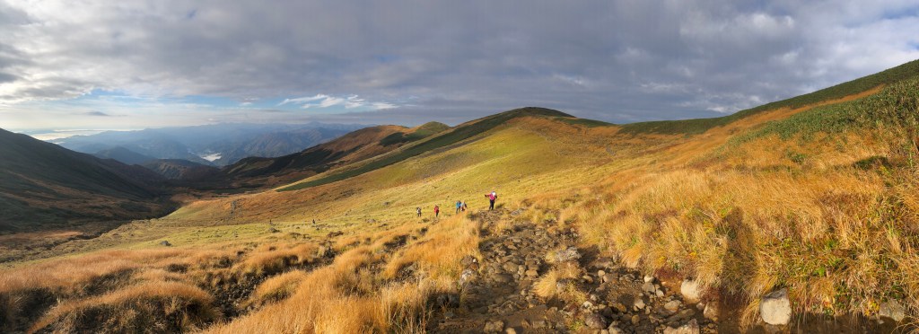
At the Omisaka parking lot there is a small toilet house, although it did not have any light nor did it provide running water when I went there. From the Omisaka parking lot, head straight to the entrance. The path will lead about 30 or so minutes through the forest until crossing a larger pathway in the forest. Follow this pathway to the right and after 10 minutes or so, the trail continues onto the direction of the mountain to the left. The next passage leads through the thick forest and is a very easy and gentle increase in elevation. After about 2 hours, you arrive at a sign post with a map and from there, the trail is going to get much steeper and there are some passages where ropes help you navigate through the rocks and a bit more difficult parts. At some point later, you should be out of the forest and climb the rest of the trail with nice view into the land (on clear days). Once arrived on what looks like the top, there is a signpost that shows the way to the actual summit of the mountain. Follow the sign and the trail leads back down first and will eventual arrive at the emergency mountain hut. From there, it is only a short climb up the actual crater of Iwate-san. Once arrived on the crater, you can go around it until you reach the highest point of the mountain. (going clock-wise is faster to the summit, but you can circle the whole crater in about an hour or a bit less, so it does not really matter which way to go). There is also a path that leads into the crater, where there is a small shrine. Worth a visit and not that far to get from the main trail. From the crater, you can decide to go down any of the routes described above, or go back the way you came from (in case you came by car etc.).
All in all, Iwate-san is a magnificent mountain. As an active volcano, it also provides rich volcanic landscape and flora. The hike itself, while taking about 8h overall return (depending on the route and your condition), is not too difficult.


