

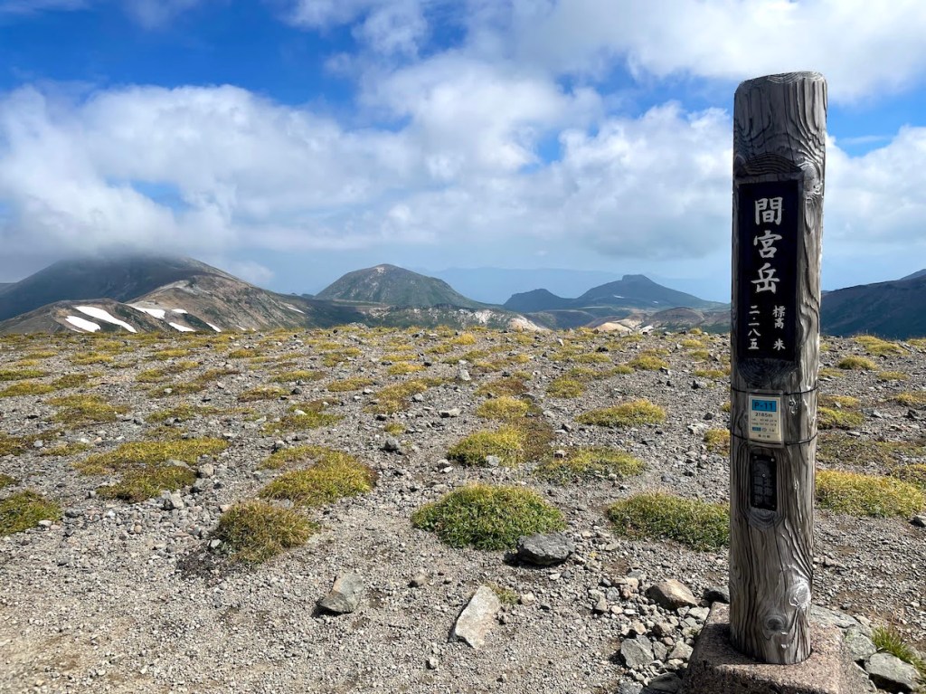

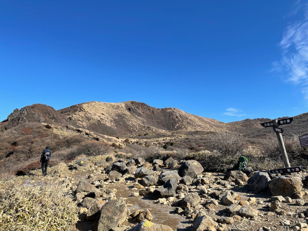
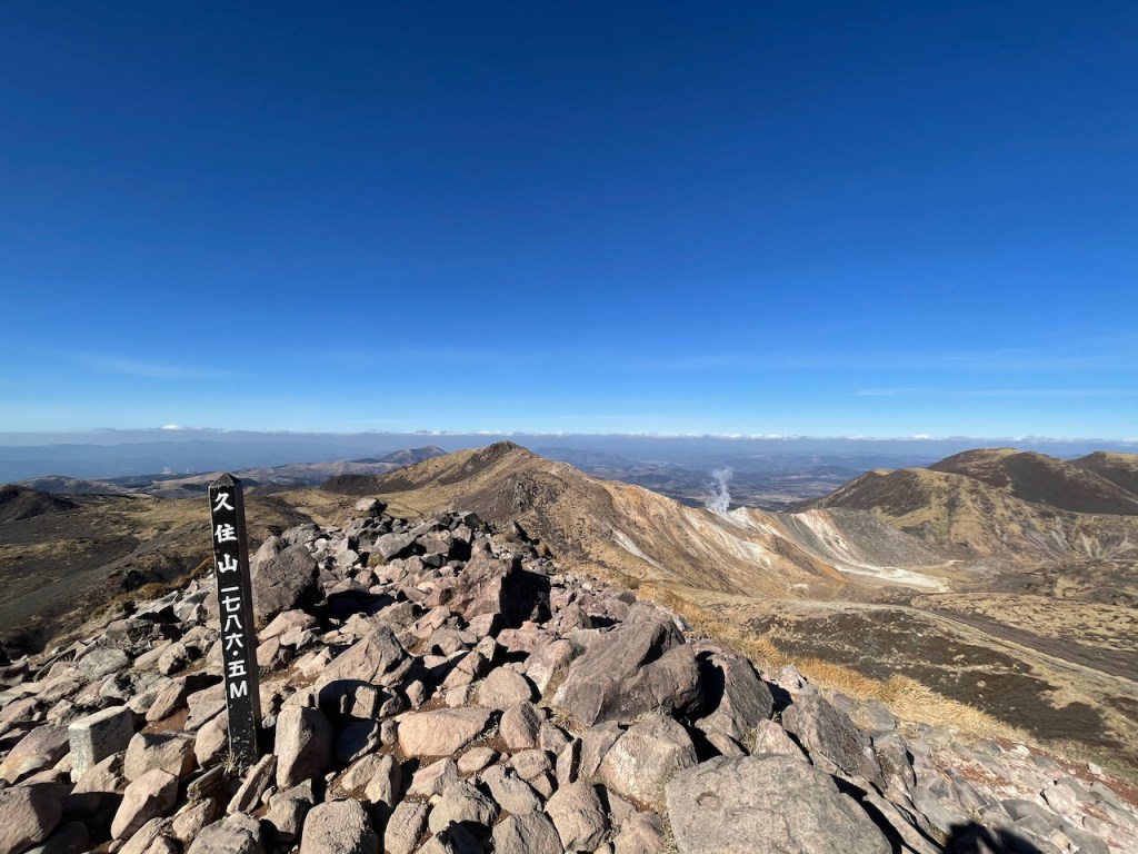
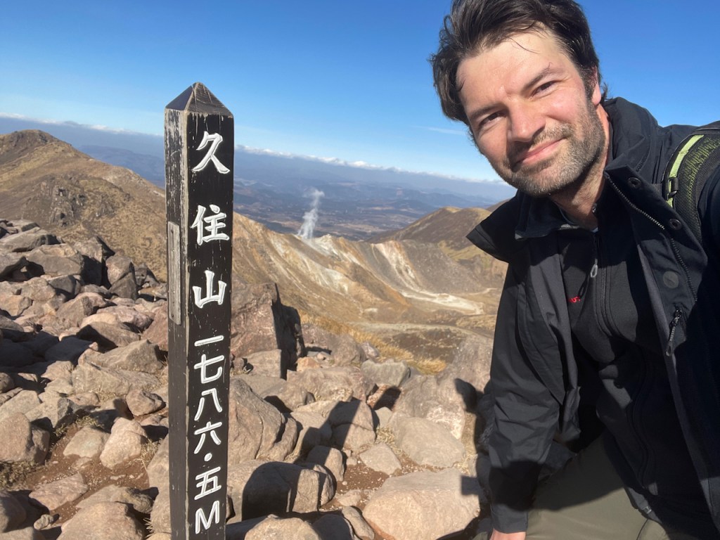
Das Kuju-san Gebirge 九重連山 ist die Gegend eines aktiven Vulkans im Zentrum Kyushus, der suedlichsten Hauptinsel in Japan. Das Gebirge umfasst ganze 17 Spitzen, die auch als eigene Berge gelten. Mindestens 10 davon liegen auf beliebten Wanderrouten. Um sie aber alle abzuklappern muss man von mehreren Seiten aufsteigen, so dass dies schwer schaffbar ist an nur einem Tag. Der bekannste Berg des Kuju Gebirges ist der Kuju-san 久住山 mit 1786.5m. Dabei ist zu beachten dass das Kanji des Berges Kuju 久住 sich vom Kanji des kompletten Gebirges 九重 unterscheidet. Das Kuju-Gebirge, oft einfach als 九重山 geschrieben auf Japanisch, stellt dabei den Eintrag in der Liste der 100 bekannten Japanischen Berge des Autors Kyuya Fukada dar.
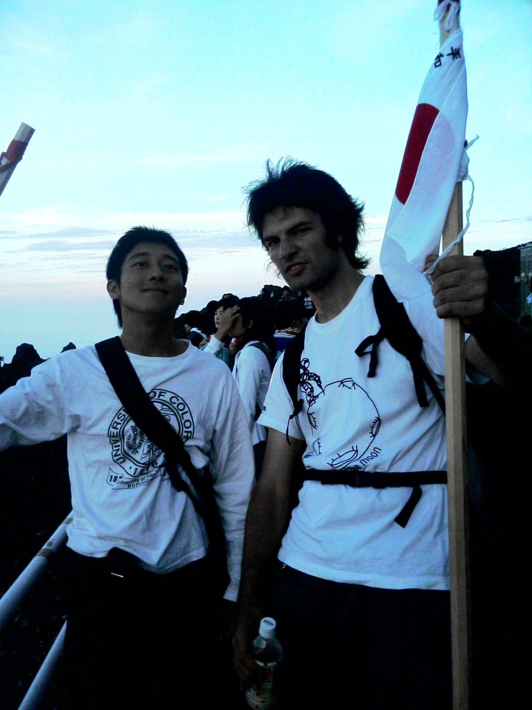
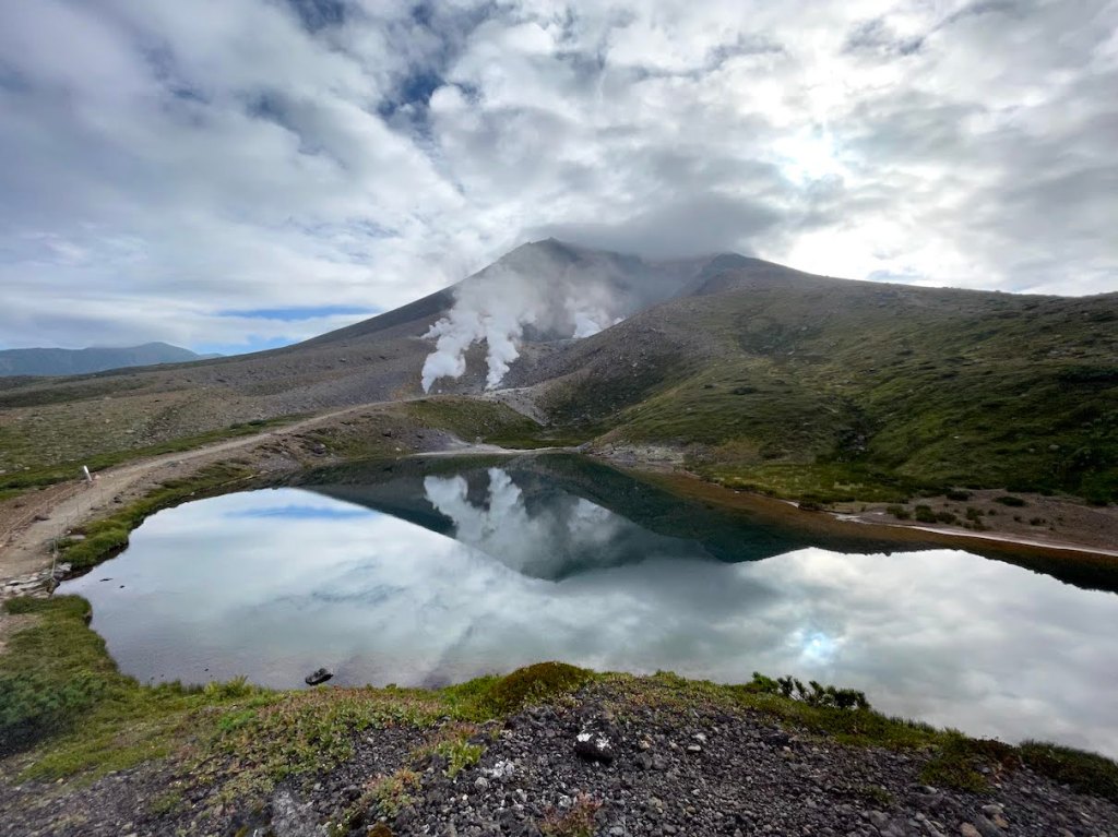
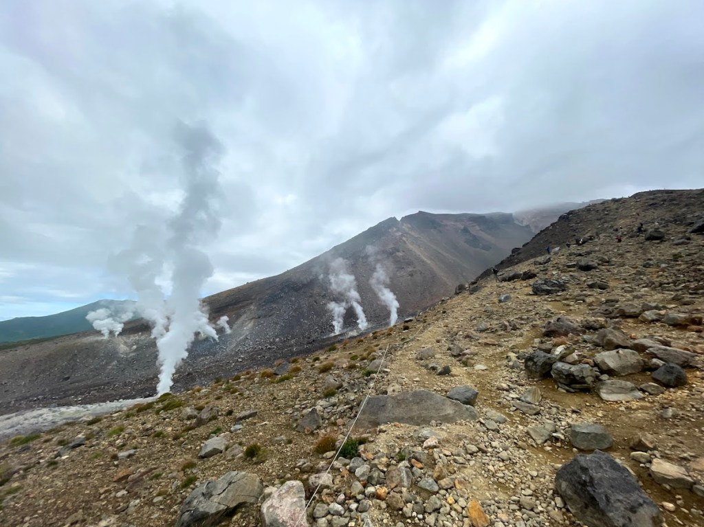
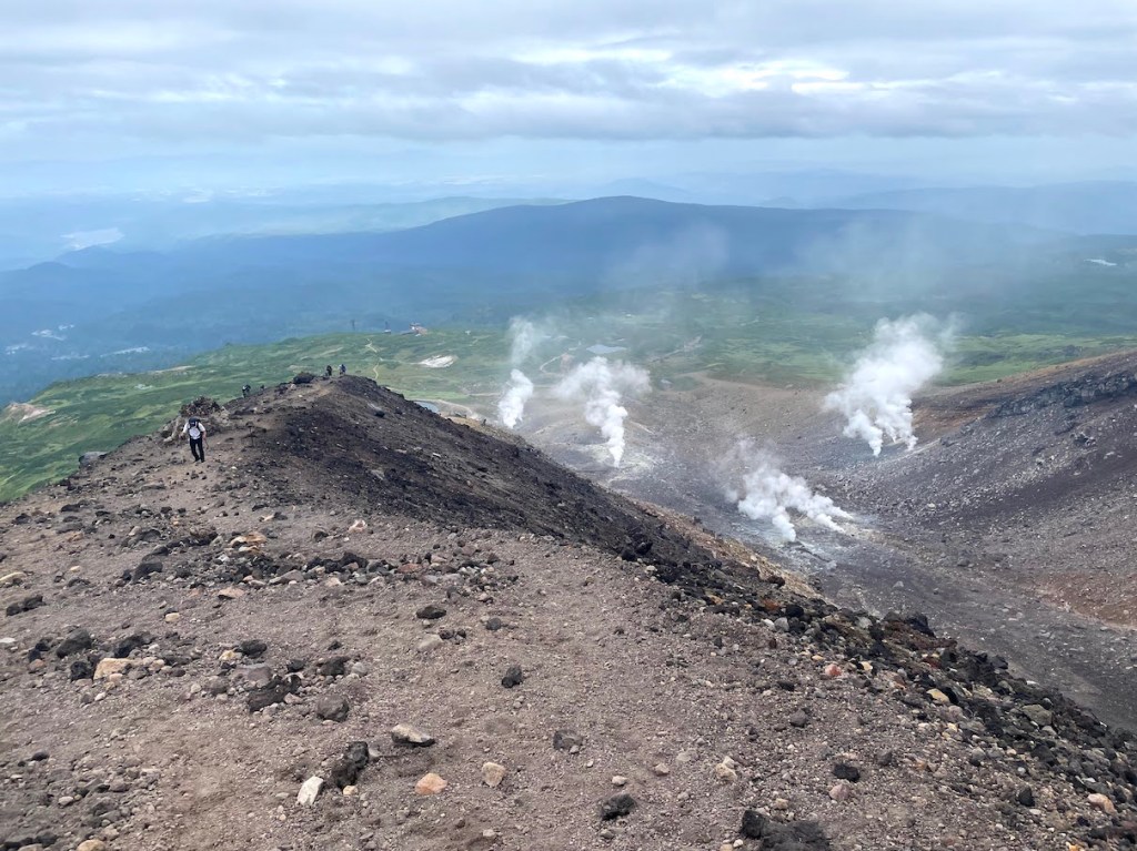
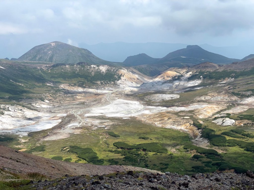
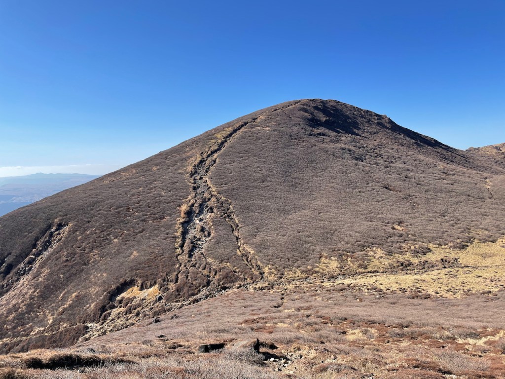
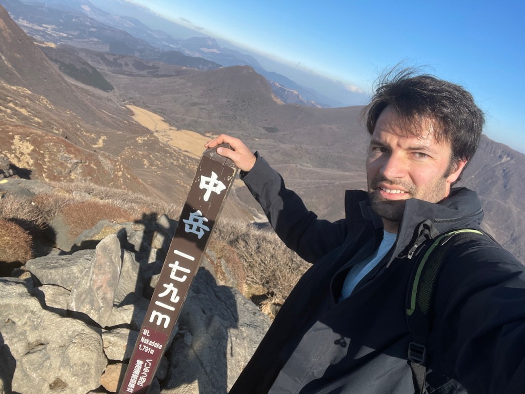
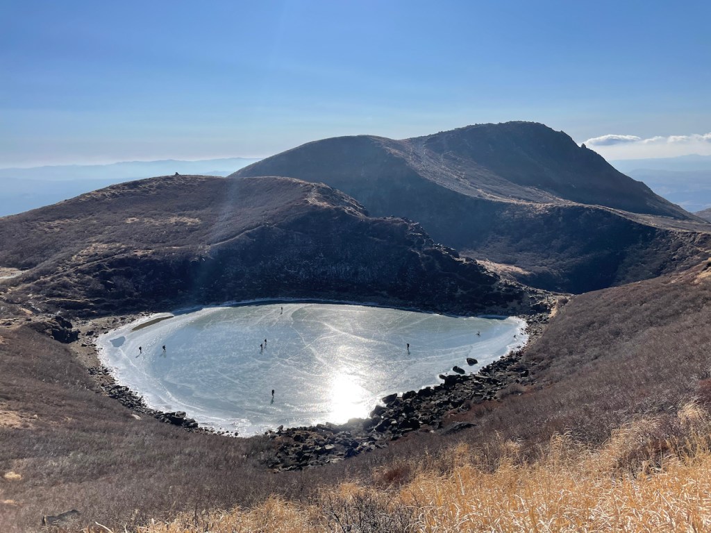
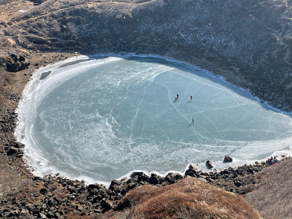
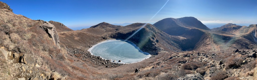
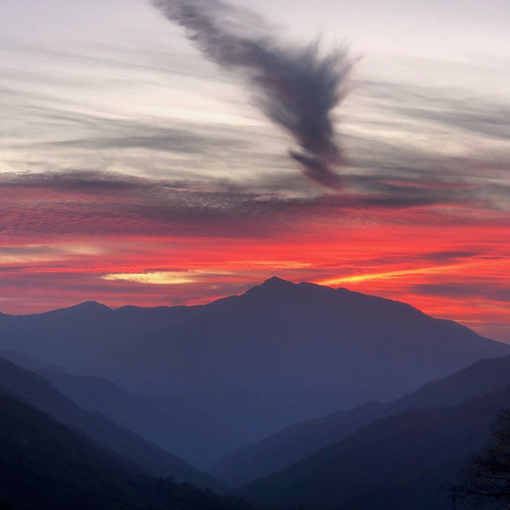
Waehrend der 久住山 der wohl bekannteste Berg ist, ist er nicht der hoechste. Die hoechste Erhebung ist der Naka-dake 中岳 mit 1791m. Vom Naka-dake hat man eine gute Sicht ueber das Vulkangebirge und am Fussse das Naka-dake befindet sich auch ein Kratersee, der Miike 御池. Als wir dort waren Ende Dezember war dieser gefroren und viele Wanderer ueberquerten ihn auf der Wanderung.
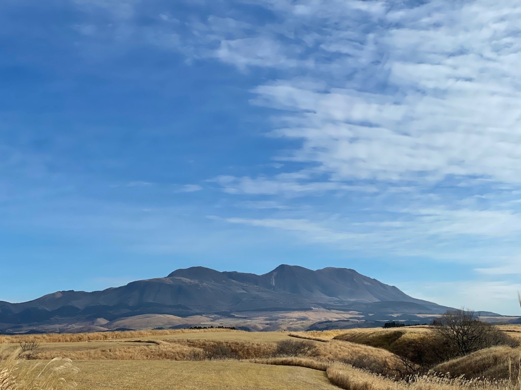

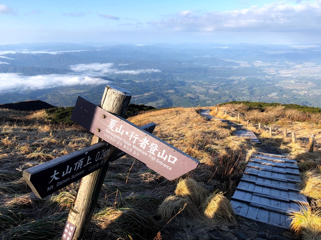
Der Daisen ist der hoechste Berg in der Praefektur Tottori (鳥取県), welche am Japanischen Meer liegt. Daisen (jp. 大山, was einfach “Grosser Berg” bedeutet und in anderen Gebieten oft Ooyama gelesen wird) ist ein relativ freistehender Berg von 1729m und gehort zu den 21 japanischen Ultras, Berge die eine Prominenz (zu dt. auch Schartenhöhe) von 1500m oder mehr haben. Der Berg wird auch manchmal als Hoki-Fuji (伯耆富士) oder Izumo-Fuji (出雲富士) bezeichnet wegen der (fraglichen) Formaehnlichkeit zum Fuji-san.
Der Hike an sich ist nicht zu schwer aber ist fast die ganze Zeit von Treppensteigen gekennzeichnet. Ab der 7ten Station bekommt man eine super Sicht auf die Umgebung, und ca 500m vor dem Gipfel passiert man ein Plateau, was von hoelzernden Laufstegen durchzogen ist. Was sicherlich im Sommer sehr angenehm ist, kann aber auch gefaehlich im Winter werden wenn die Laufstege vereist und sehr rutschig sind. So war es auch als wir hoch sind und man musste sich sehr langsam bewegen um nicht staendig hinzufallen. Zudem war es Anfang November schon richtig kalt auf dem Gipfel (Minusgrade).
Nachdem ein Erdbeben den eigentlichen Gipfel des Berges, den Kengamine (剣ヶ峰), nicht mehr zugaenglich gemacht hat, fuehren die Wanderwege aktuell nur auf maximal den Misen (弥山), der mit einer Hoehe von 1709m aber nur 20 Meter niedriger ist.


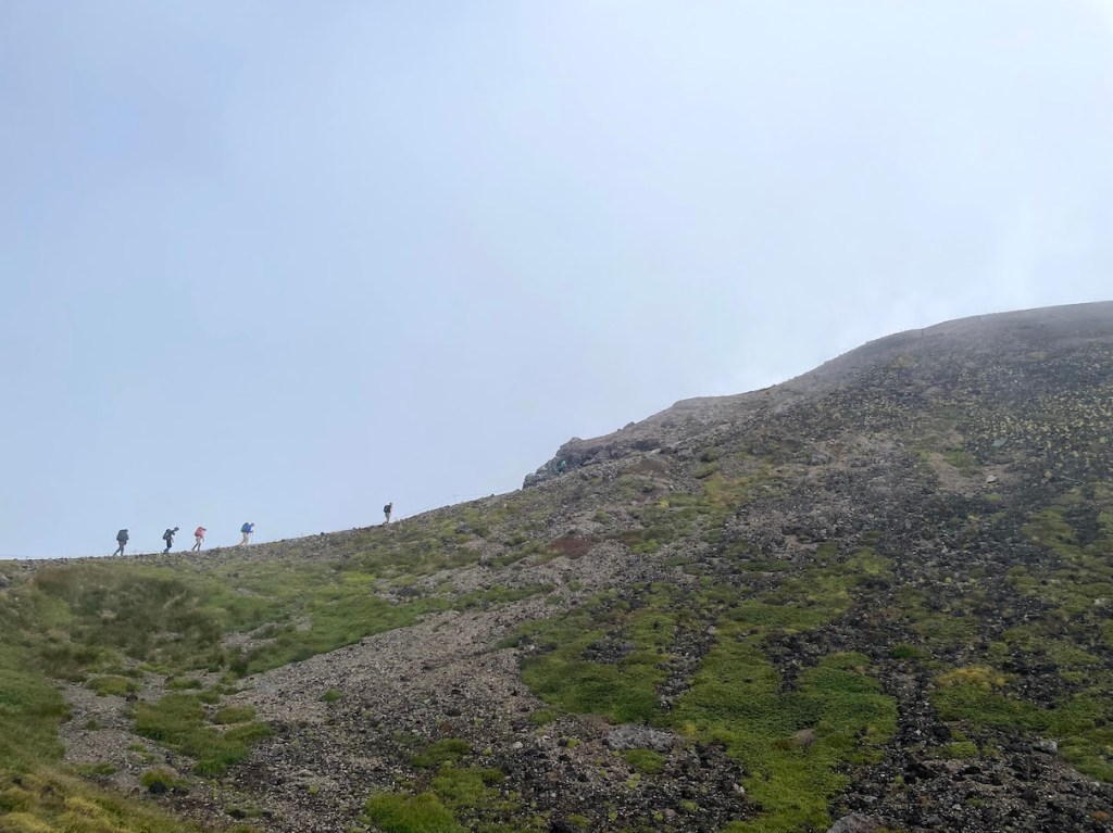
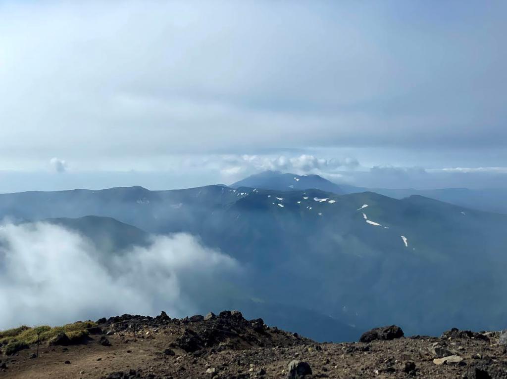
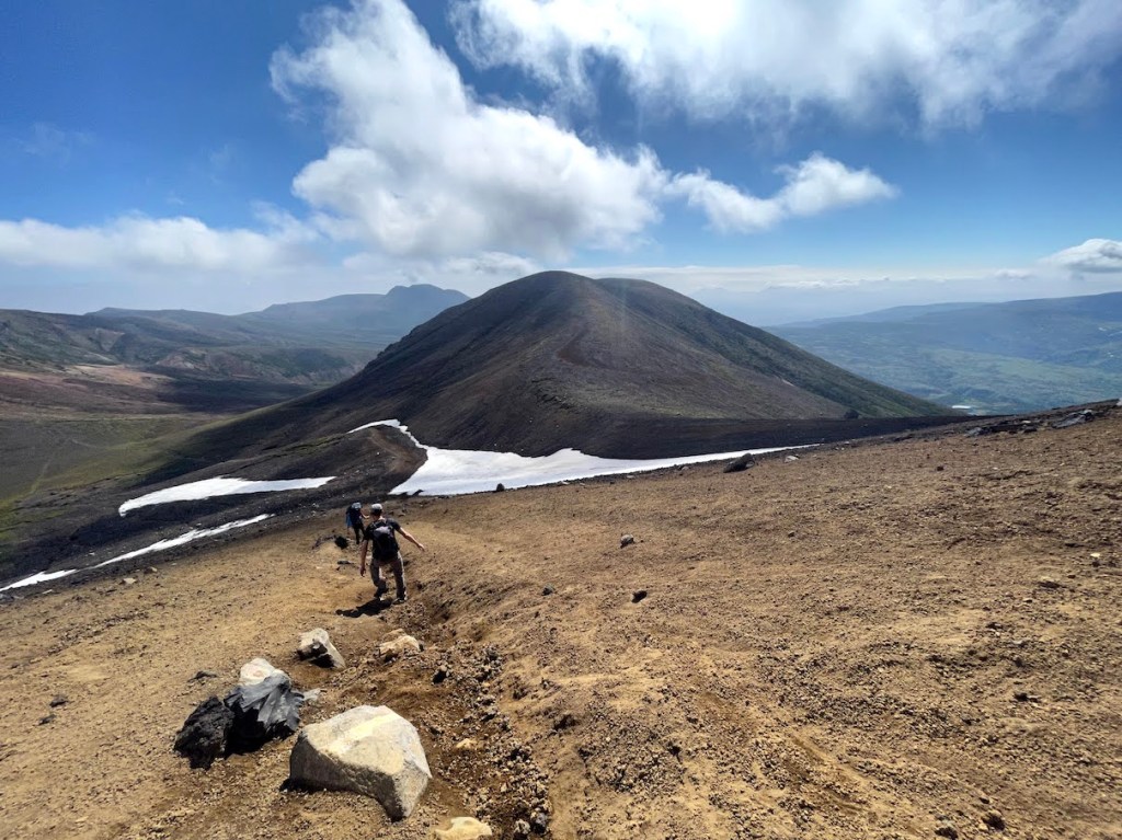
Der Iwate-san 岩手山 (oder auch Iwate-Fuji 岩手富士/Nanbu-Fuji 南部富士/Nanbukata-Fuji 南部片富士 genannt) ist ein imposanter Schichtvulkan, der ueber die Stadt Morioka wacht. Als relativ freistehender Vulkan und mit ueber 2000m Hoehe gehoert er auch zu den 21 Ultras in Japan. Ultras sind solche Berge/Vulkane, die eine topographische Prominenz von 1500 oder mehr haben, also solche die sich sehr stark in der Landschaft hervorheben. Der Anstieg ist nicht allzuschwer, aber sehr lange, da man von relativ weit unten anfaengt. Oben angekommen wird man jedoch mit der Marsaehnlichen Landschaft eines sehr schoenen Vulkankraters belohnt.
–
Iwate-san is one of Japan’s 21 Ultras and shares the same name the northern Japanese prefecture in where it is located. Iwate-san is located not far from the city of Morioka (the capital of Iwate prefecture) and due to its ultra prominent peak, can be seen from almost anywhere in the region. It is a majestic active volcano that watches over Morioka and the region. Iwate-san is also included in the list of 100 famous mountains compiled by mountaineer Kyuya Fukuda in 1964.
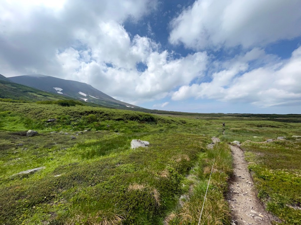
The hike can be approach by several trails outlined below. While all the trails lead to the summit in the end, there are a variety of reasons for people choosing a certain route. The Umagaeshi route is by far the most popular. Near the start of the Yakehashiri route, there is an impressing wide field of lava rock to be visited, and the Amihari route is the longest route that also starts and ends right at an Onsen area. When we approached the mountain in August 2020, we chose the Omisaka route, which starts at the Omisaka parking lot in the south. This route, while not being the most known, I felt it was a good choice since there were not many climbers on this path (I think I saw about a handful the whole time (except for when we reached the summit, of course) .This post and its description therefore focuses on the Omikasa-route.
| No | Route Name | ルート | Time (ascend only) | Notes |
|---|---|---|---|---|
| 1 | Umagaeshi-Route | 馬返しコース | ~ 4.5h | Most popular route |
| 2 | Yakehashiri-Route | 焼走りコース | ~ 5h | Starts at a large lava field |
| 3 | Uwabo-Route | 上坊コース | ~ 4h | Starts at a shrine |
| 4 | Nanataki-Route | 七滝コース | ~ 6h | – |
| 5 | Matsukawa-Route | 松川コース | ~ 6h+ | – |
| 6 | Amihari-Route | 網張コース | ~ 6h+ | Longest route, starts at Amihara-Onsen |
| 7 | Omisaka-Route | 御神坂コース | ~ 4.5h+ | – |
The 6 hiking routes to the summit of Iwate-san.
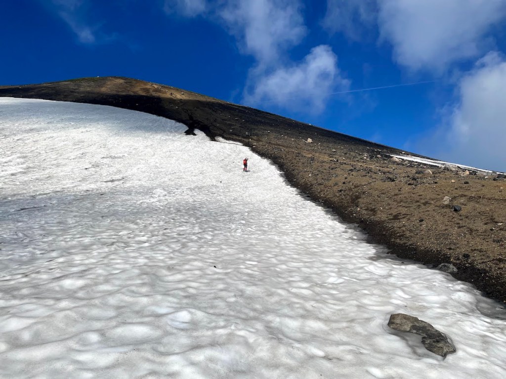
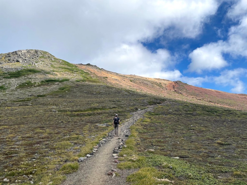
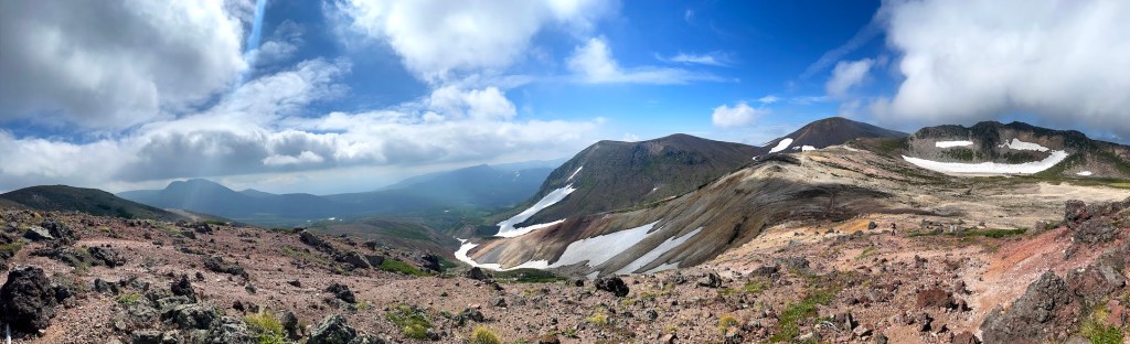
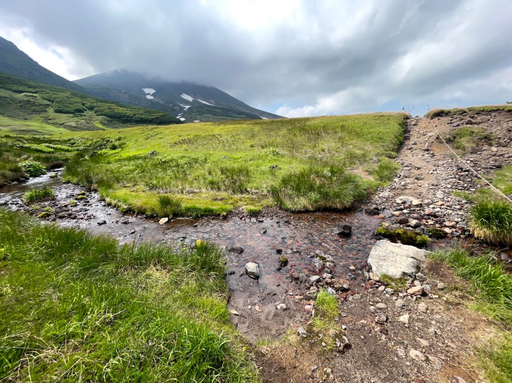
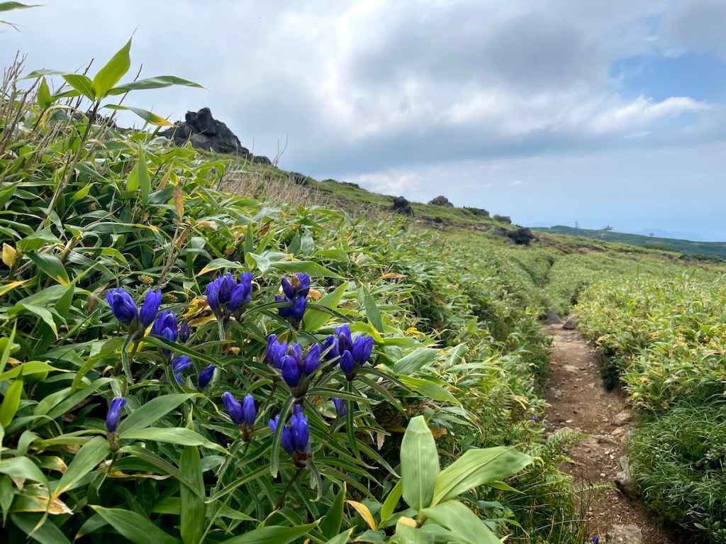
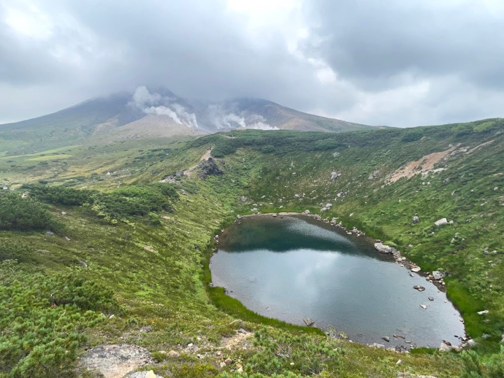
At the Omisaka parking lot there is a small toilet house, although it did not have any light nor did it provide running water when I went there. From the Omisaka parking lot, head straight to the entrance. The path will lead about 30 or so minutes through the forest until crossing a larger pathway in the forest. Follow this pathway to the right and after 10 minutes or so, the trail continues onto the direction of the mountain to the left. The next passage leads through the thick forest and is a very easy and gentle increase in elevation. After about 2 hours, you arrive at a sign post with a map and from there, the trail is going to get much steeper and there are some passages where ropes help you navigate through the rocks and a bit more difficult parts. At some point later, you should be out of the forest and climb the rest of the trail with nice view into the land (on clear days). Once arrived on what looks like the top, there is a signpost that shows the way to the actual summit of the mountain. Follow the sign and the trail leads back down first and will eventual arrive at the emergency mountain hut. From there, it is only a short climb up the actual crater of Iwate-san. Once arrived on the crater, you can go around it until you reach the highest point of the mountain. (going clock-wise is faster to the summit, but you can circle the whole crater in about an hour or a bit less, so it does not really matter which way to go). There is also a path that leads into the crater, where there is a small shrine. Worth a visit and not that far to get from the main trail. From the crater, you can decide to go down any of the routes described above, or go back the way you came from (in case you came by car etc.).
All in all, Iwate-san is a magnificent mountain. As an active volcano, it also provides rich volcanic landscape and flora. The hike itself, while taking about 8h overall return (depending on the route and your condition), is not too difficult.


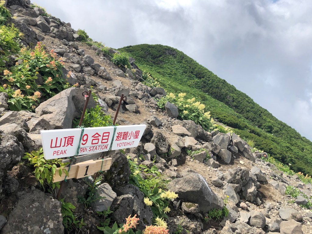
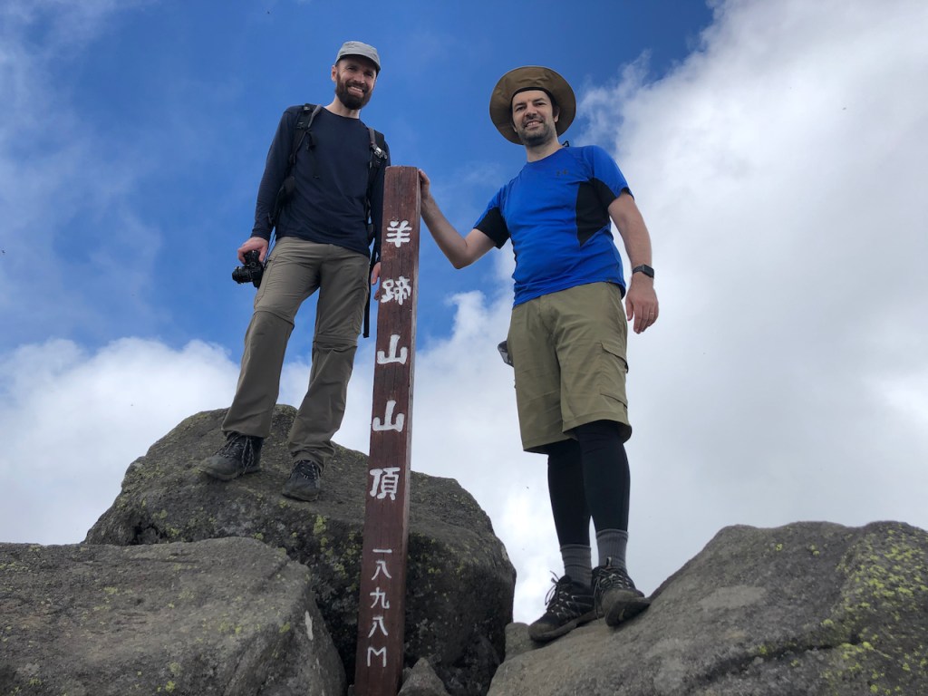
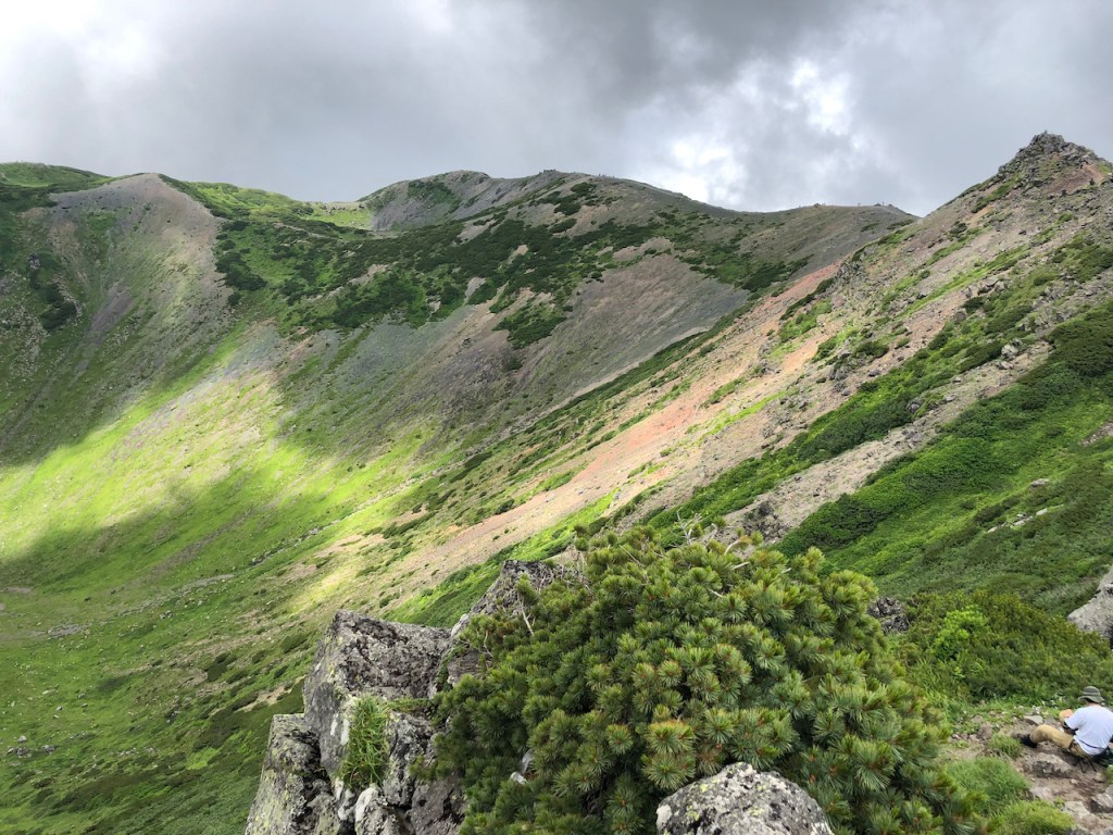
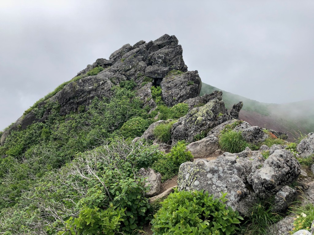
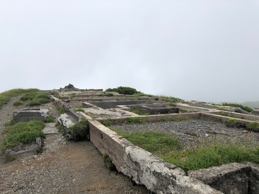
Der Yotei-san 羊蹄山, oder auch Shiribeshi-yama 後方羊蹄山 genannt, ist ein maechtiger Schichtvulkan, der sich in der beliebten Japanischen Ski-Gegend Niseko auf Hokkaido erhebt. Fuer die Besteigung sollte man so frueh wie moeglich los und einen kompletten Tag einplanen. Der Berg ist zwar nur knapp 1900m, aber da man von fast ganz unten anfaengt, zieht sich der Anstieg sehr. Der Berg und auch der Gipfelkrater sind absolut fantastisch und wer von dem langen Anstieg nicht abgeschreckt wird, der wird mit sehr schonen Kraterlandschaften auf dem Gipfel belohnt. Wenn man einmal um den Gipfel laeuft, dann stoesst man auch auf das Fundament einer Berghuette die vor geraumer Zeit aufgegeben wurde.
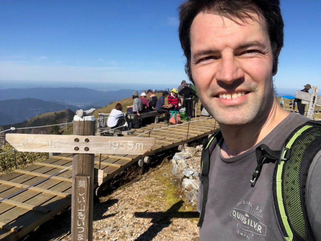
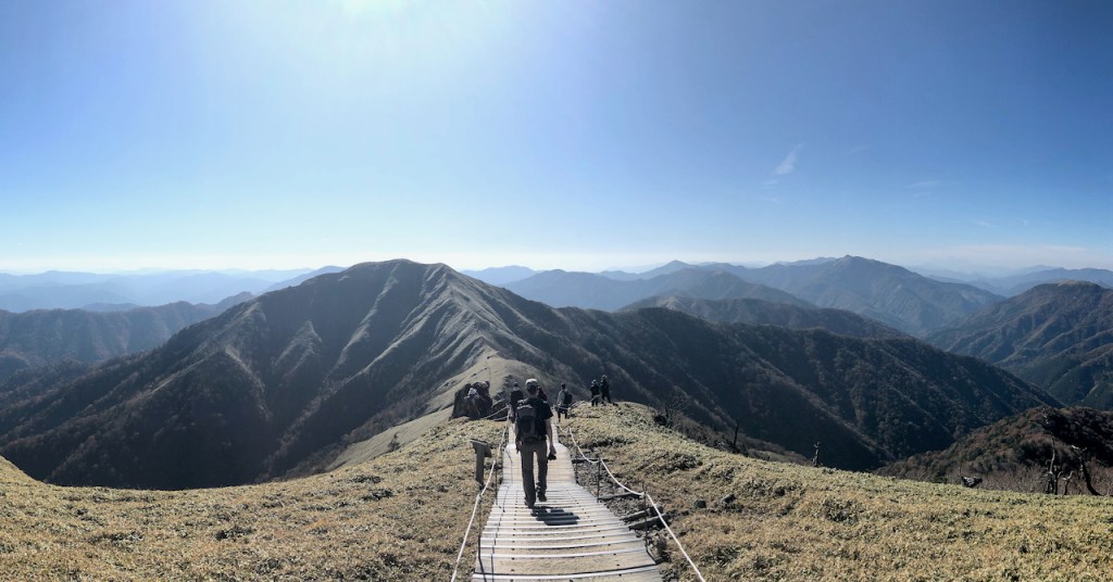
Der Tsurugi-san 剣山 auf Shikoku (nicht zu verwechseln mit dem Tsurugi-dake 剣岳 in den Kita Alps, ebenfalls ein Hyakumeizan ist), ist recht einfach mit dem Auto zu erreichen. Vom Parkplatz ist es dann nurnoch ca. 1.5h bis zur Spitze. Wahlweise kann man auch den Weg mit einem Lift verkuerzen. Oben angekommen offenbahrt sich ein schoenes Bergpanorama und wenn man Zeit hat kann man auch noch die benachbarten Spitzen besuchen, wie zb. den Jirogyu 次郎笈.

Der Meizan schlechthin.