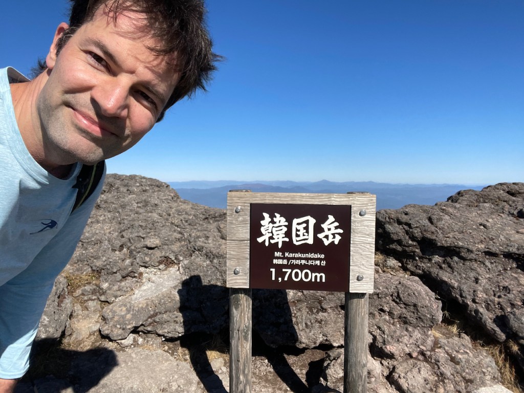
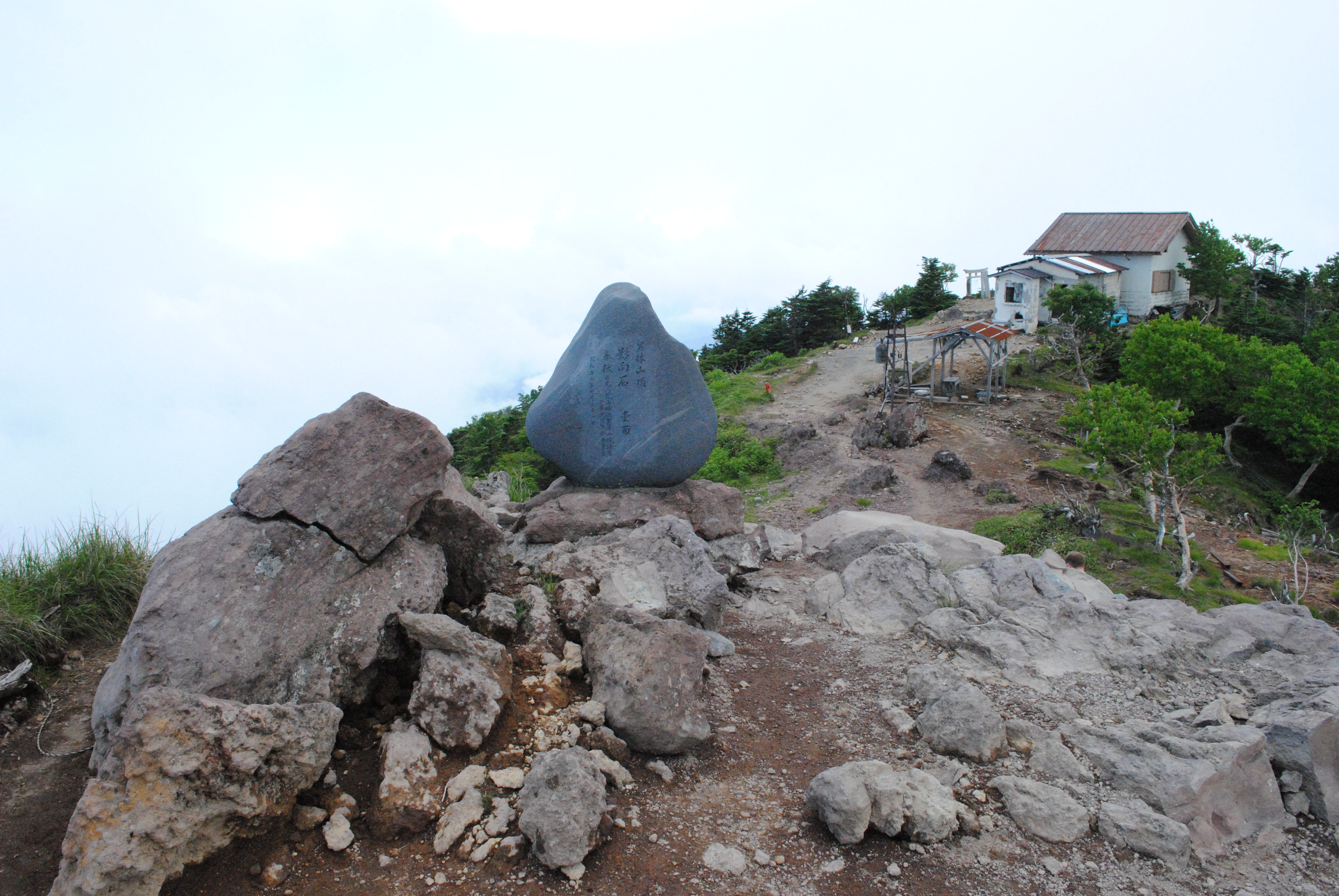
Das Kirishima 霧島 Gebirge ist eine wunderschoene Landschaft aktiver Vulkane noerdlich der japanischen Stadt mit dem gleichen Namen (霧島市) in der Provinz Kagoshima 鹿児島, gelegen auf der suedlichsten Hauptinsel Kyushu 九州. Die hoechste Erhebung ist der Karakuni-dake 韓国岳 mit stolzen 1700m. Fun fact: die ersten beiden Kanji sind die gleichen, welche fuer das Land Sued-Korea benutzt werden. Das ganze Kirishima Gebirge ist sehr markant und kann auch aus Richtung Haneda im Anflug auf den Flughafen Kagoshima auf der rechten Seite bewundert werden.
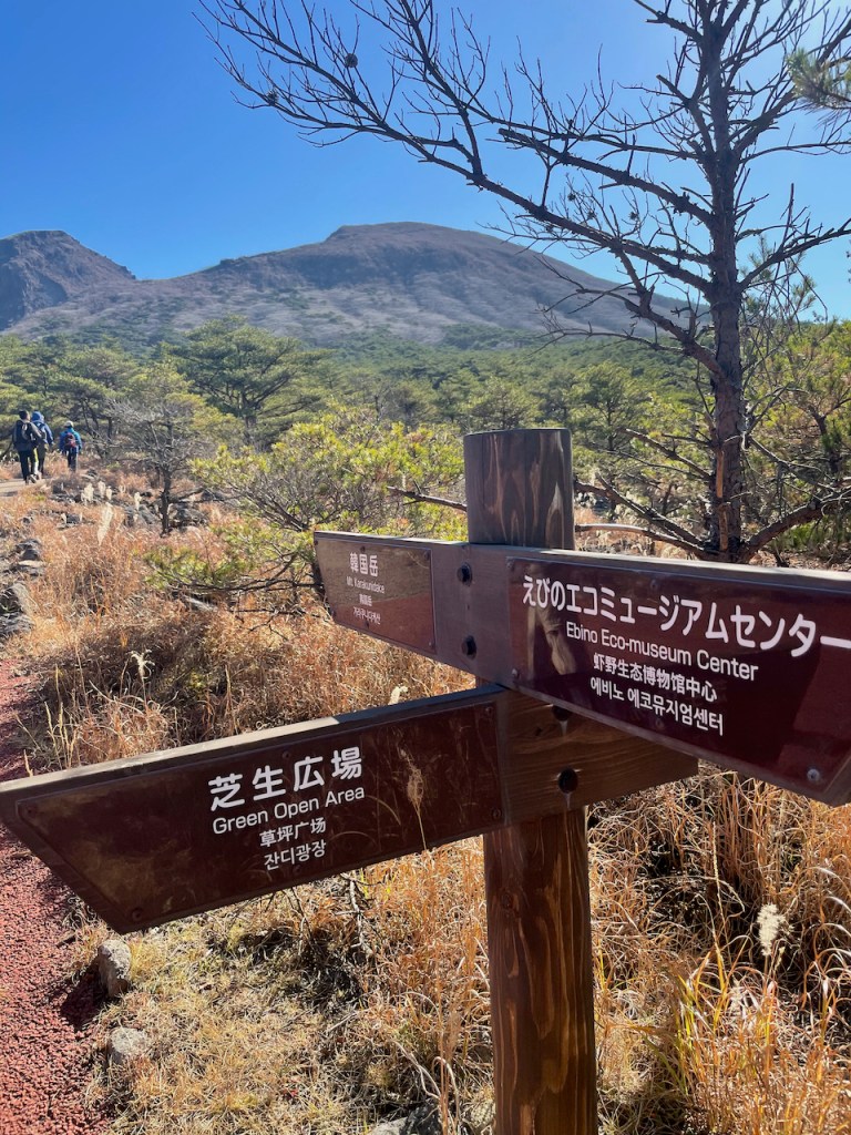
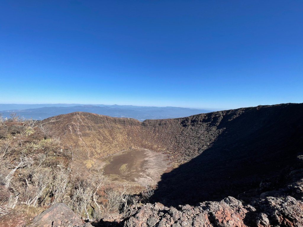
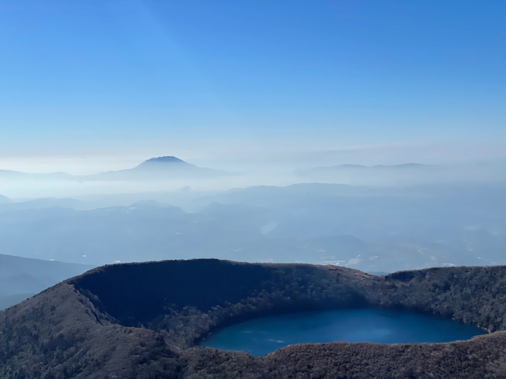
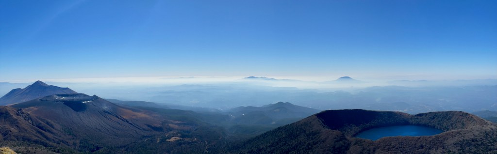
Die Wanderwege starten auf dem Ebino Hochland えびの高原, wo es auch genug Parkplaetze gibt. Wer eine Alternativroute nehmen will, kann auch kurz vor dem Ebino Hochland Parkplatz an der Zubringerstrasse aus Richtung Kirishima-Stadt an den Parkplaetzen links/rechts von der Strasse halten wenn Platz ist. Dort, aber unweit vom Ebino Hochland, started die Route zum Karakuni-dake ueber den Onami Teich 大波池, einen sehr schoenen Vulkankrater mit kristallklarem Wasser gefuellt, ebenso auf den Karakuni-dake. Wir haben die Route vom Ebino Hochland genommen die in gut einer Stunde hoch auf den Karakuni-dake fuehrt. Absteigen kann man wahlweise ueber den Onami Teich/Krater (das wuerde ich empfehlen) oder den gleichen Weg wieder zurueck.
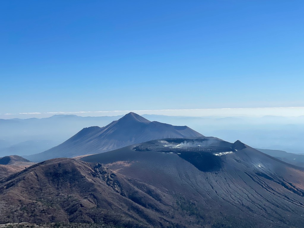
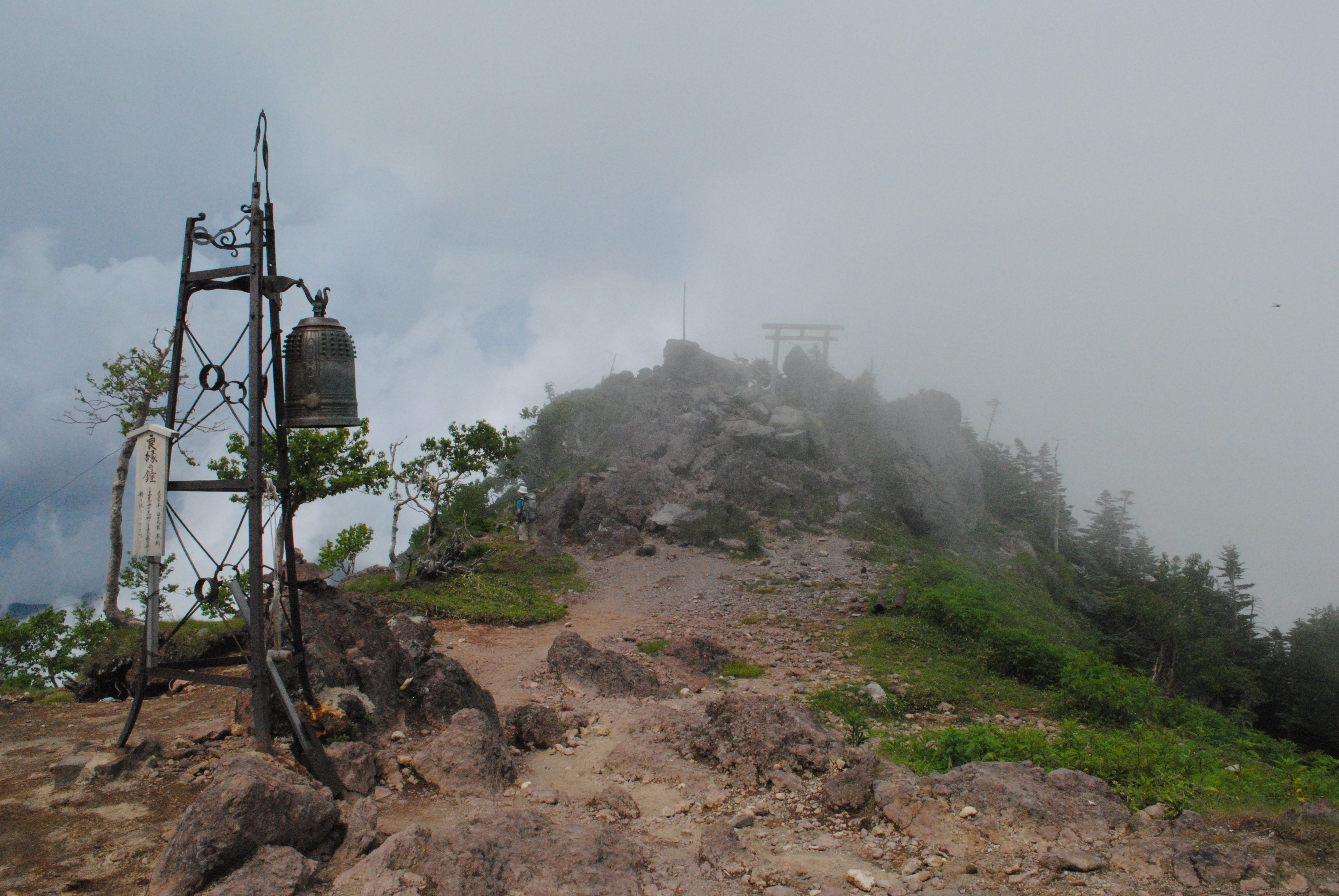
Vom Gipfel aus sieht man auch einen sehr aktiven, rauchenden Vulkan, then Shinmoe-dake 新燃岳. Diesen konnte man frueher auch besteigen (der Wanderweg fuehrt vom Karakuni-dake auch hin), jedoch ist die Route wegen der erhoehten vulkanishcen Aktivitaet des Berges gesperrt. Auf dem Abstieg haben wir einen aelterne ehrenamtlichen Wanderfuehrer getroffen, der uns erzaehlt hat, dass man den Shinmoe-dake frueher ohen probleme besteigen konnte und er auch oft gemacht hat, der weg jedoch seit ueber 12 Jahren bereits gesperrt ist. Danach hat er uns auch seine Wanderkarte von Kirishima geschenkt, sehr nett. Sollte der Shinmoe-dake irgendeinmal wieder begehbar sein, dann sollte man vielleiht recht schnell versuchen ihn zu besteigen. Bei Vulkanen weiss man nie wann sie das naechste mal wieder aktiver werden und die Route wieder gesperrt wird.
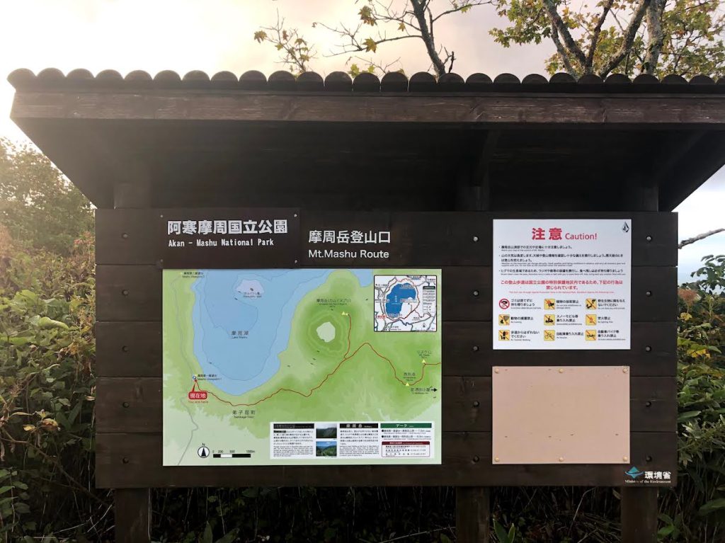
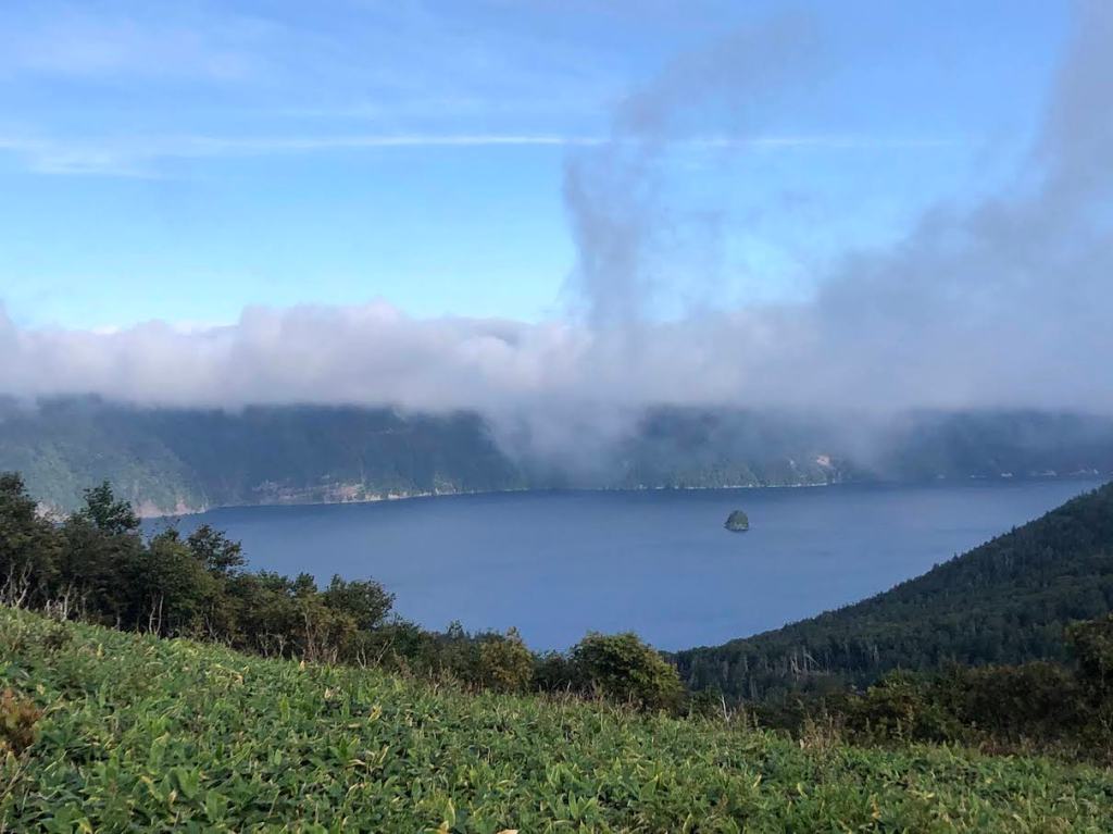
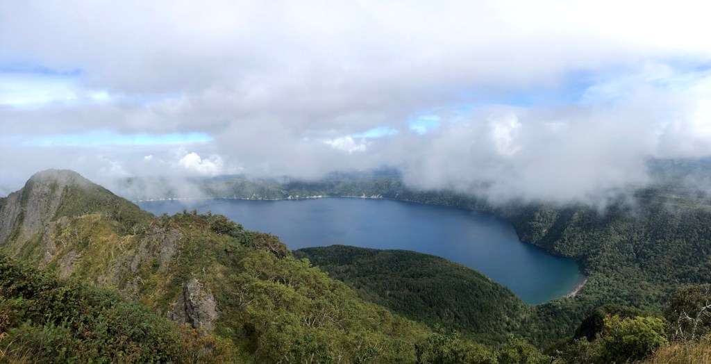
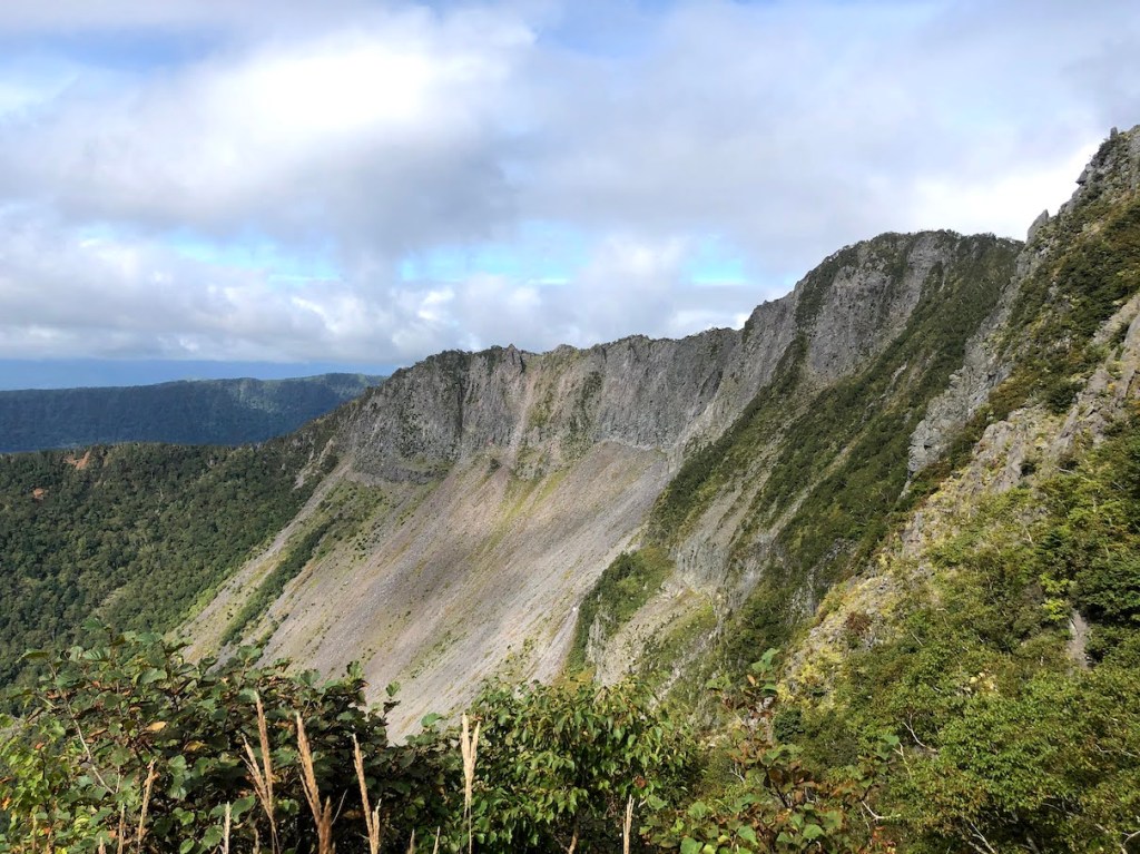
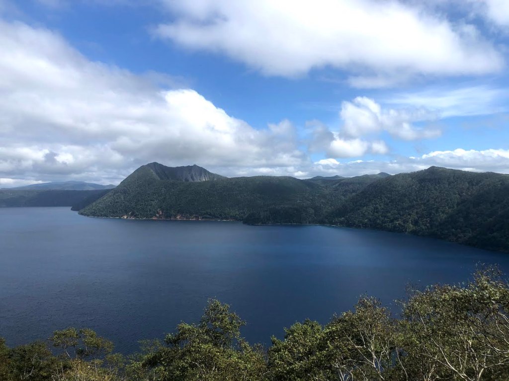
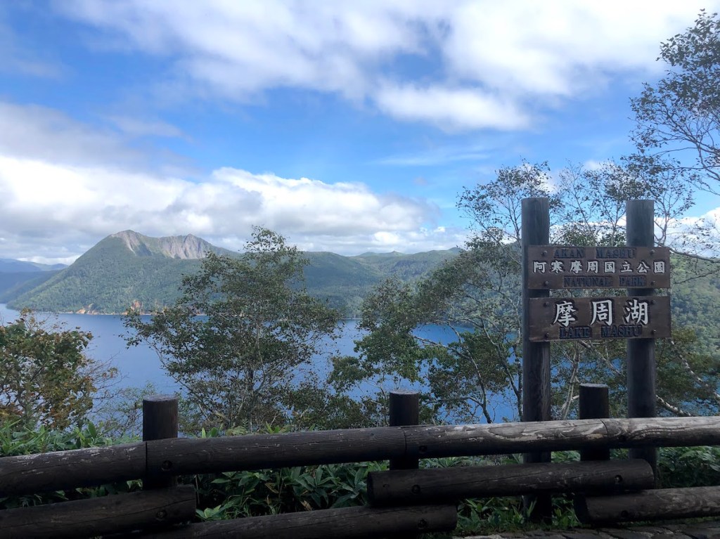
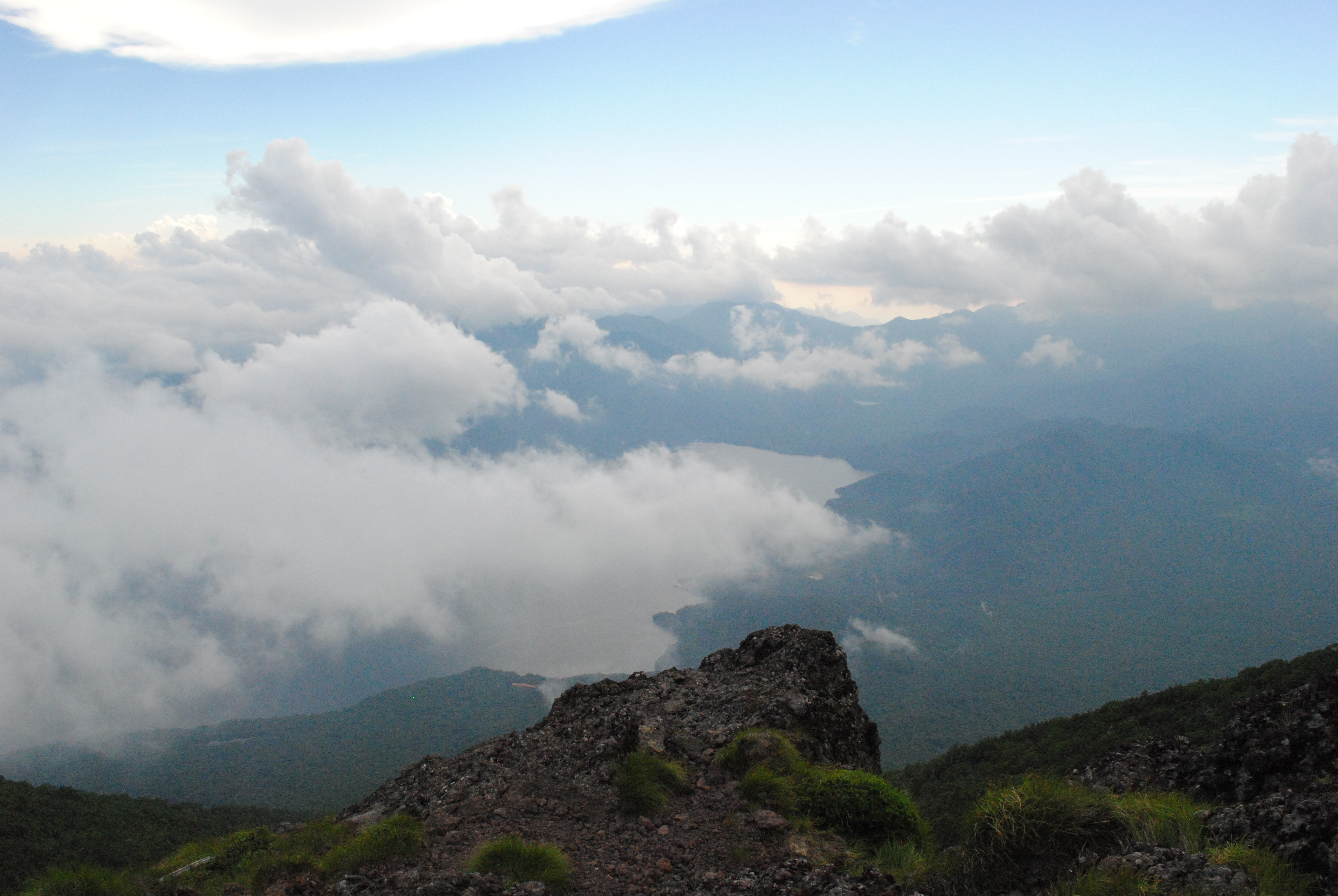
As with many mountains in Japan, there can be more than one way to call it. Mt. Mashu, or Mashu-dake 摩周岳, is also called Kamui-nupuri カムイヌプリ, which means “mountain of the gods” in Ainu, the language of the ingenious people of Hokkaido. The mountain is situated on the edge of Lake Mashu 摩周湖., a lake with beautifully blue water, which is also worth a visit, even without the goal of climbing Mashu-dake. While the whole lake was created within a large volcanic crater, Mashu-dake is basically a smaller sub-crater, not filled with water, but not less impressive.
The most popular trailhead start at he first viewing platform for Lake Mashu and the Mashu-dake. It is easily reachable by car and there is also a bus station. When arriving by car, parking costs 500yen. If you arrive early morning, there is a chance that no-one will be present at the gates, but in this case, they will put a note behind the windshield wipers for you to report back to the parking lot office once you come back from the hike. If you need to rely on public transportation, there is a bus from Mashu Station 摩周駅 that goes to the first observation deck, but the times and frequencies are quite rare. Here is the schedule.
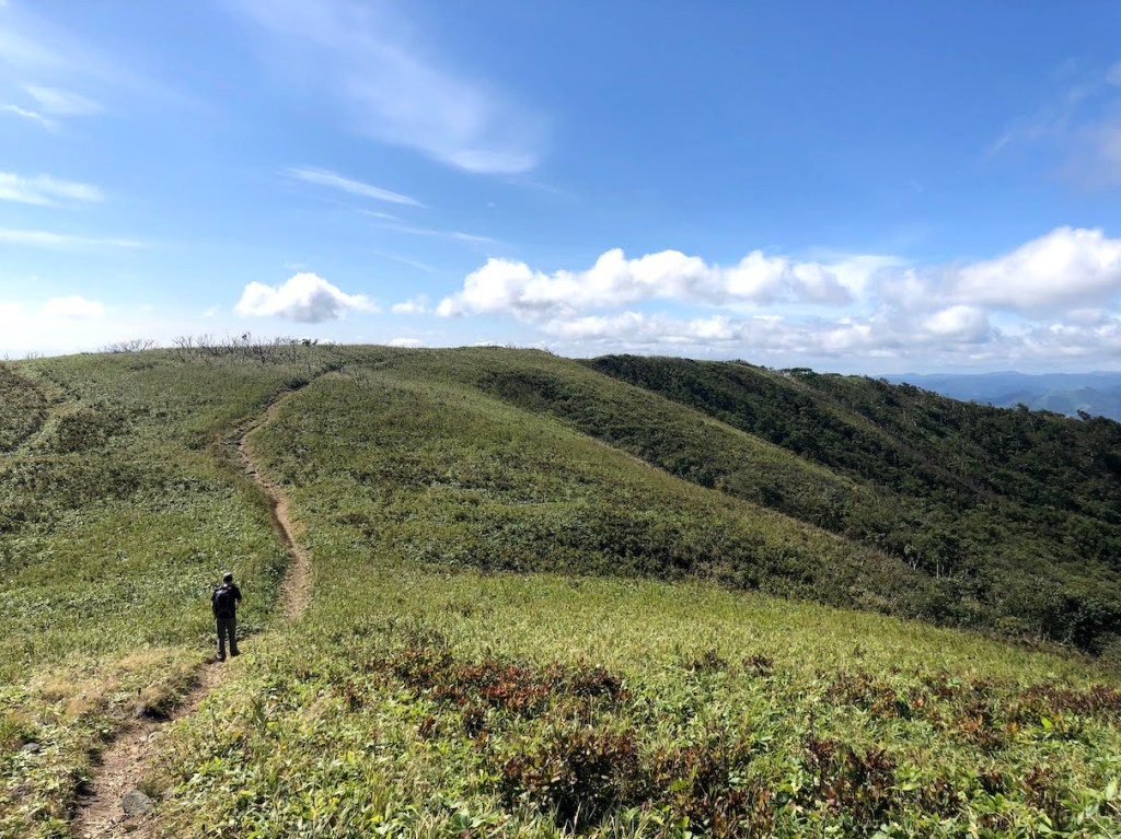
Once you enter the trailhead which begins right at the end of the viewpoint area, the majority of the trail will be rather easy and relaxing. There is not much elevation gain until the very last 400m or so. The reason for this is that you first need to walk a while around the lake to the Mashu-dake. But the trail leads you through enchanting forests and wide fields with views on both the Lake Mashu and the surrounding mountains such as Nishibetsu-dake 西別岳. About halfway through, there is another viewing platform with great views on Lake Mashu and Mashu-dake. Head further straight until you reach another junction. From here, you can take the left side right up to the summit of Mashu-dake, or take the right side to further hike to Nishibetsu-dake, which is only 2.5km away. The majority of the elevation gain happens during the last 400m of the hike, but with a total elevation gain of about 400m, this is not a difficult hike.
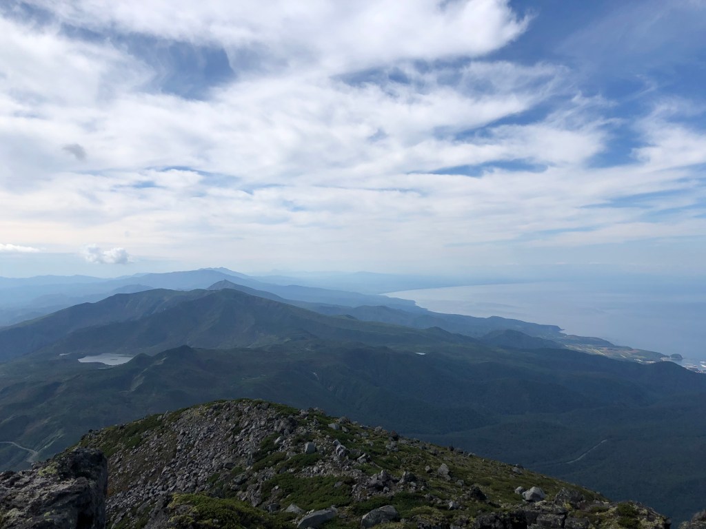
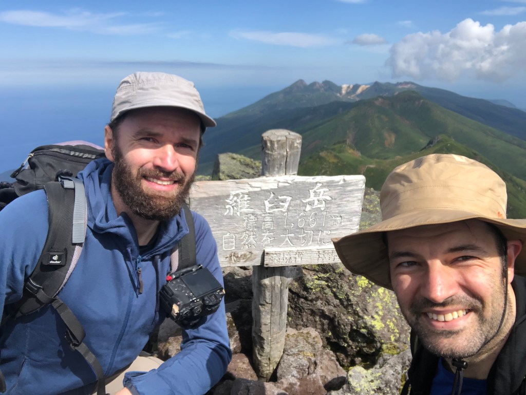
Blick vom steinigen Gipfel des Rausu-dake. Bei gutem Wetter kann man bis nach Kunashiri (unter Russland’s Kontrolle aber terretorial beansprucht von Japan) schauen.
Der Iwate-san 岩手山 (oder auch Iwate-Fuji 岩手富士/Nanbu-Fuji 南部富士/Nanbukata-Fuji 南部片富士 genannt) ist ein imposanter Schichtvulkan, der ueber die Stadt Morioka wacht. Als relativ freistehender Vulkan und mit ueber 2000m Hoehe gehoert er auch zu den 21 Ultras in Japan. Ultras sind solche Berge/Vulkane, die eine topographische Prominenz von 1500 oder mehr haben, also solche die sich sehr stark in der Landschaft hervorheben. Der Anstieg ist nicht allzuschwer, aber sehr lange, da man von relativ weit unten anfaengt. Oben angekommen wird man jedoch mit der Marsaehnlichen Landschaft eines sehr schoenen Vulkankraters belohnt.
–
Iwate-san is one of Japan’s 21 Ultras and shares the same name the northern Japanese prefecture in where it is located. Iwate-san is located not far from the city of Morioka (the capital of Iwate prefecture) and due to its ultra prominent peak, can be seen from almost anywhere in the region. It is a majestic active volcano that watches over Morioka and the region. Iwate-san is also included in the list of 100 famous mountains compiled by mountaineer Kyuya Fukuda in 1964.
The hike can be approach by several trails outlined below. While all the trails lead to the summit in the end, there are a variety of reasons for people choosing a certain route. The Umagaeshi route is by far the most popular. Near the start of the Yakehashiri route, there is an impressing wide field of lava rock to be visited, and the Amihari route is the longest route that also starts and ends right at an Onsen area. When we approached the mountain in August 2020, we chose the Omisaka route, which starts at the Omisaka parking lot in the south. This route, while not being the most known, I felt it was a good choice since there were not many climbers on this path (I think I saw about a handful the whole time (except for when we reached the summit, of course) .This post and its description therefore focuses on the Omikasa-route.
No
Route Name
ルート
Time (ascend only)
Notes
1
Umagaeshi-Route
馬返しコース
~ 4.5h
Most popular route
2
Yakehashiri-Route
焼走りコース
~ 5h
Starts at a large lava field
3
Uwabo-Route
上坊コース
~ 4h
Starts at a shrine
4
Nanataki-Route
七滝コース
~ 6h
–
5
Matsukawa-Route
松川コース
~ 6h+
–
6
Amihari-Route
網張コース
~ 6h+
Longest route, starts at Amihara-Onsen
7
Omisaka-Route
御神坂コース
~ 4.5h+
–
The 6 hiking routes to the summit of Iwate-san.
At the Omisaka parking lot there is a small toilet house, although it did not have any light nor did it provide running water when I went there. From the Omisaka parking lot, head straight to the entrance. The path will lead about 30 or so minutes through the forest until crossing a larger pathway in the forest. Follow this pathway to the right and after 10 minutes or so, the trail continues onto the direction of the mountain to the left. The next passage leads through the thick forest and is a very easy and gentle increase in elevation. After about 2 hours, you arrive at a sign post with a map and from there, the trail is going to get much steeper and there are some passages where ropes help you navigate through the rocks and a bit more difficult parts. At some point later, you should be out of the forest and climb the rest of the trail with nice view into the land (on clear days). Once arrived on what looks like the top, there is a signpost that shows the way to the actual summit of the mountain. Follow the sign and the trail leads back down first and will eventual arrive at the emergency mountain hut. From there, it is only a short climb up the actual crater of Iwate-san. Once arrived on the crater, you can go around it until you reach the highest point of the mountain. (going clock-wise is faster to the summit, but you can circle the whole crater in about an hour or a bit less, so it does not really matter which way to go). There is also a path that leads into the crater, where there is a small shrine. Worth a visit and not that far to get from the main trail. From the crater, you can decide to go down any of the routes described above, or go back the way you came from (in case you came by car etc.).
All in all, Iwate-san is a magnificent mountain. As an active volcano, it also provides rich volcanic landscape and flora. The hike itself, while taking about 8h overall return (depending on the route and your condition), is not too difficult.
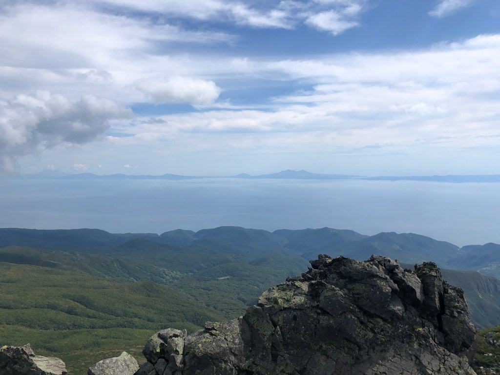
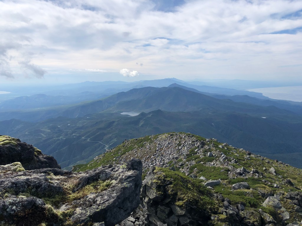
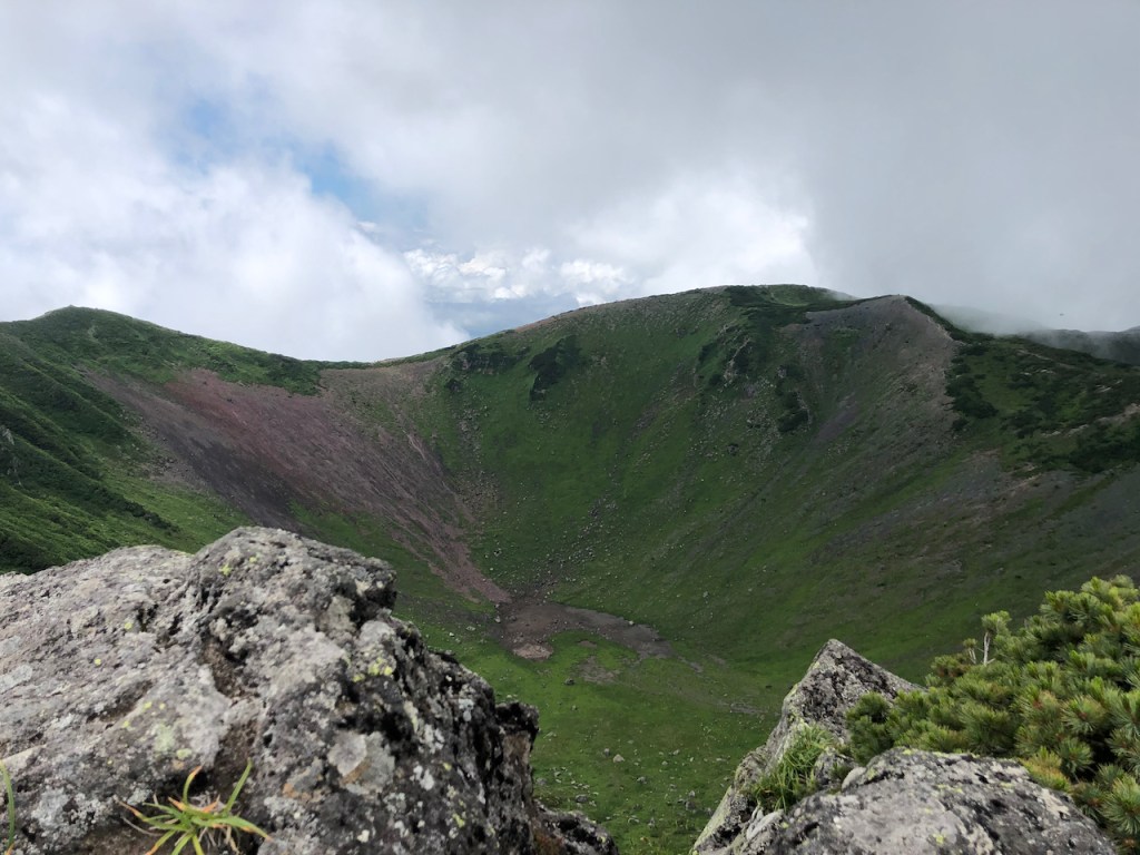
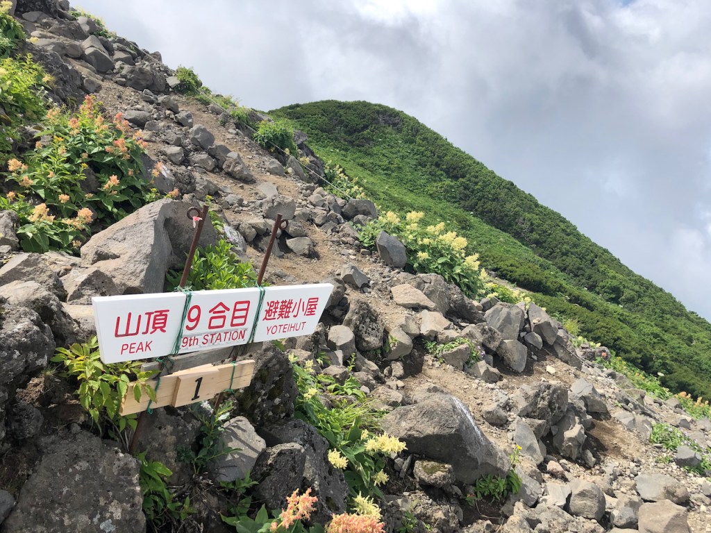
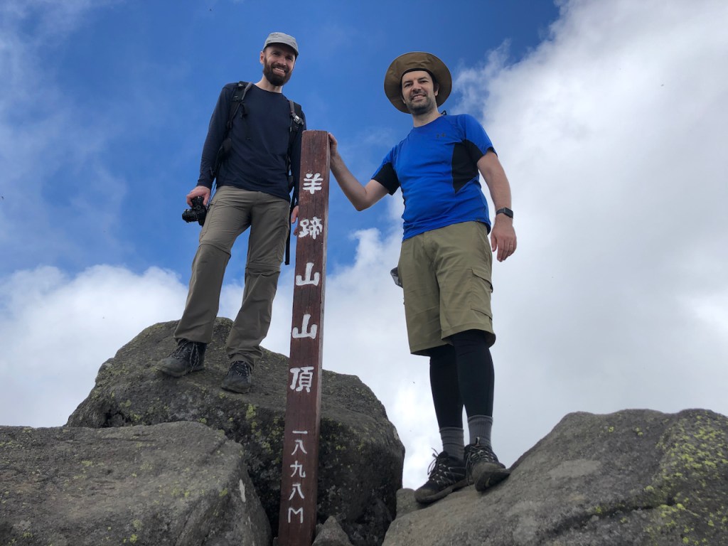
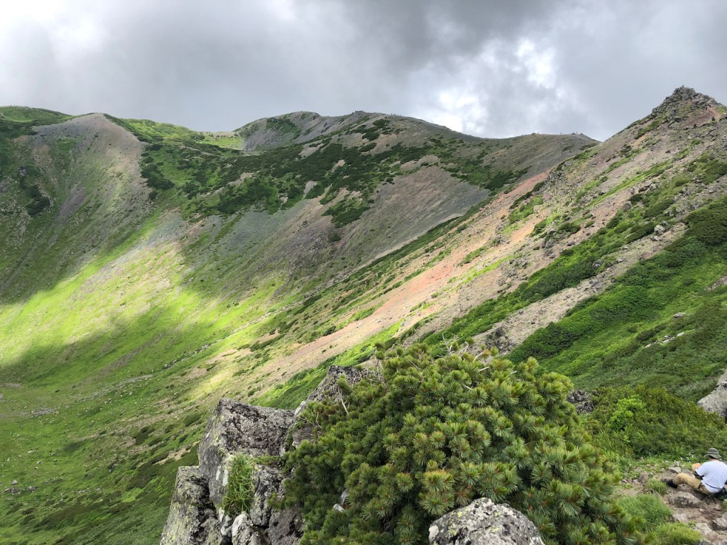
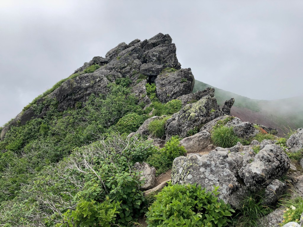
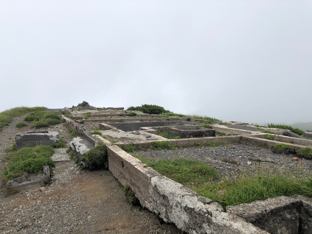
Der Yotei-san 羊蹄山, oder auch Shiribeshi-yama 後方羊蹄山 genannt, ist ein maechtiger Schichtvulkan, der sich in der beliebten Japanischen Ski-Gegend Niseko auf Hokkaido erhebt. Fuer die Besteigung sollte man so frueh wie moeglich los und einen kompletten Tag einplanen. Der Berg ist zwar nur knapp 1900m, aber da man von fast ganz unten anfaengt, zieht sich der Anstieg sehr. Der Berg und auch der Gipfelkrater sind absolut fantastisch und wer von dem langen Anstieg nicht abgeschreckt wird, der wird mit sehr schonen Kraterlandschaften auf dem Gipfel belohnt. Wenn man einmal um den Gipfel laeuft, dann stoesst man auch auf das Fundament einer Berghuette die vor geraumer Zeit aufgegeben wurde.
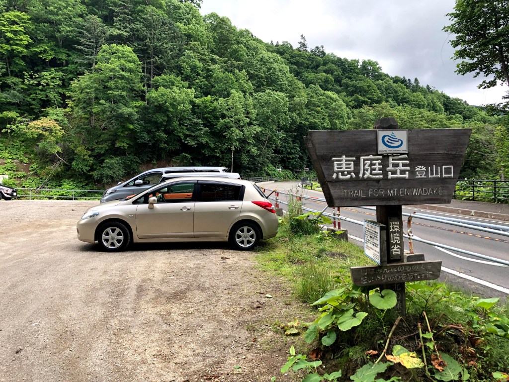
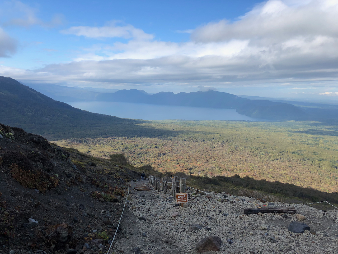
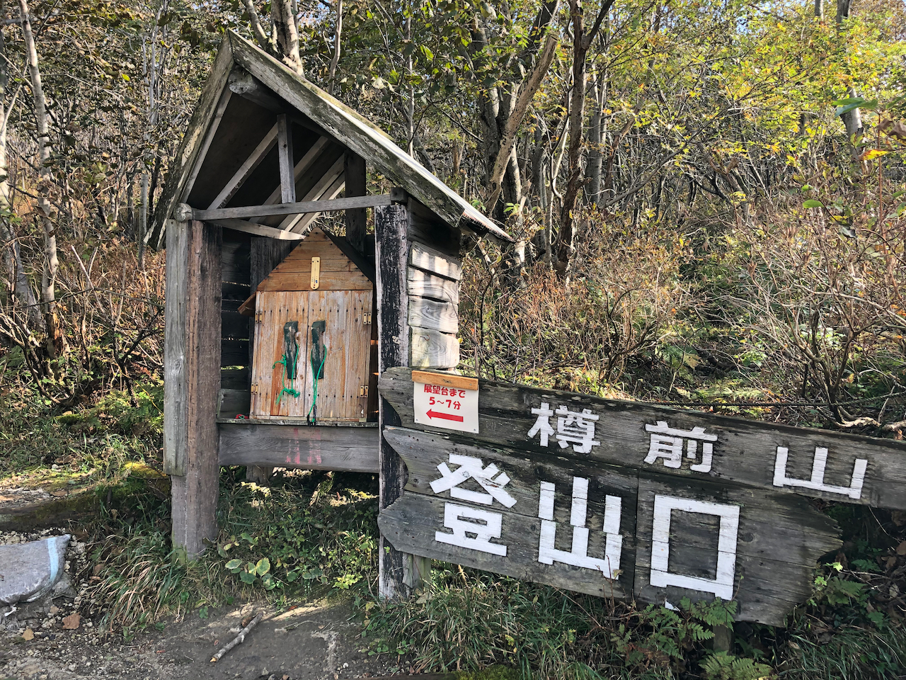
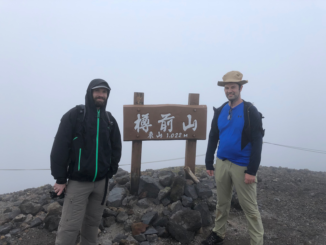
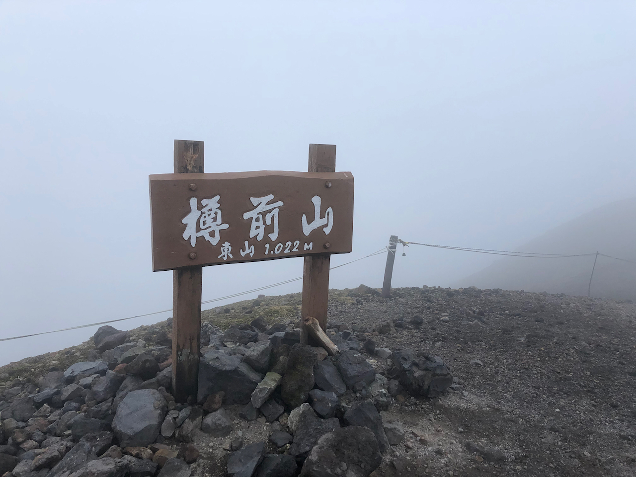
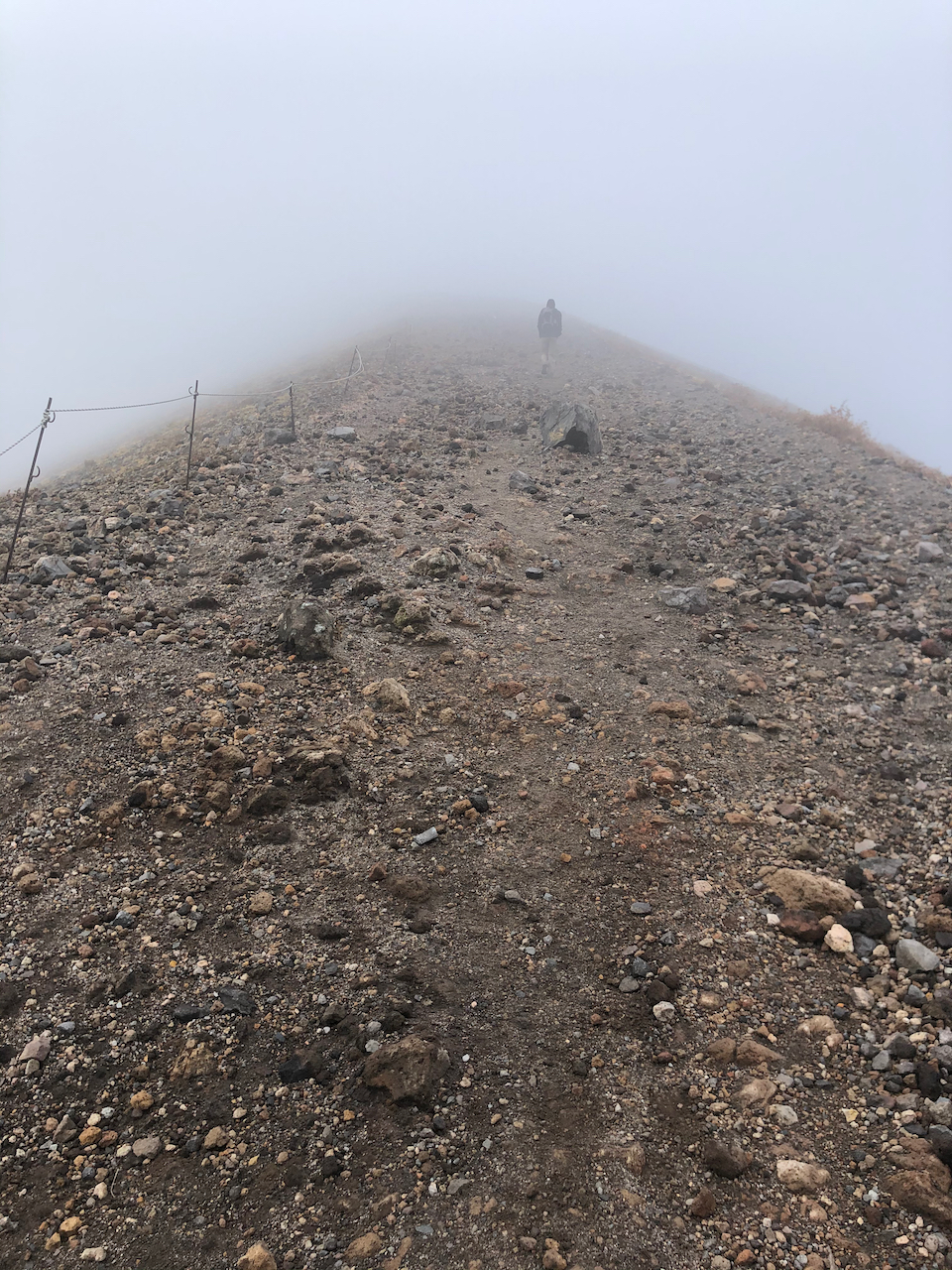
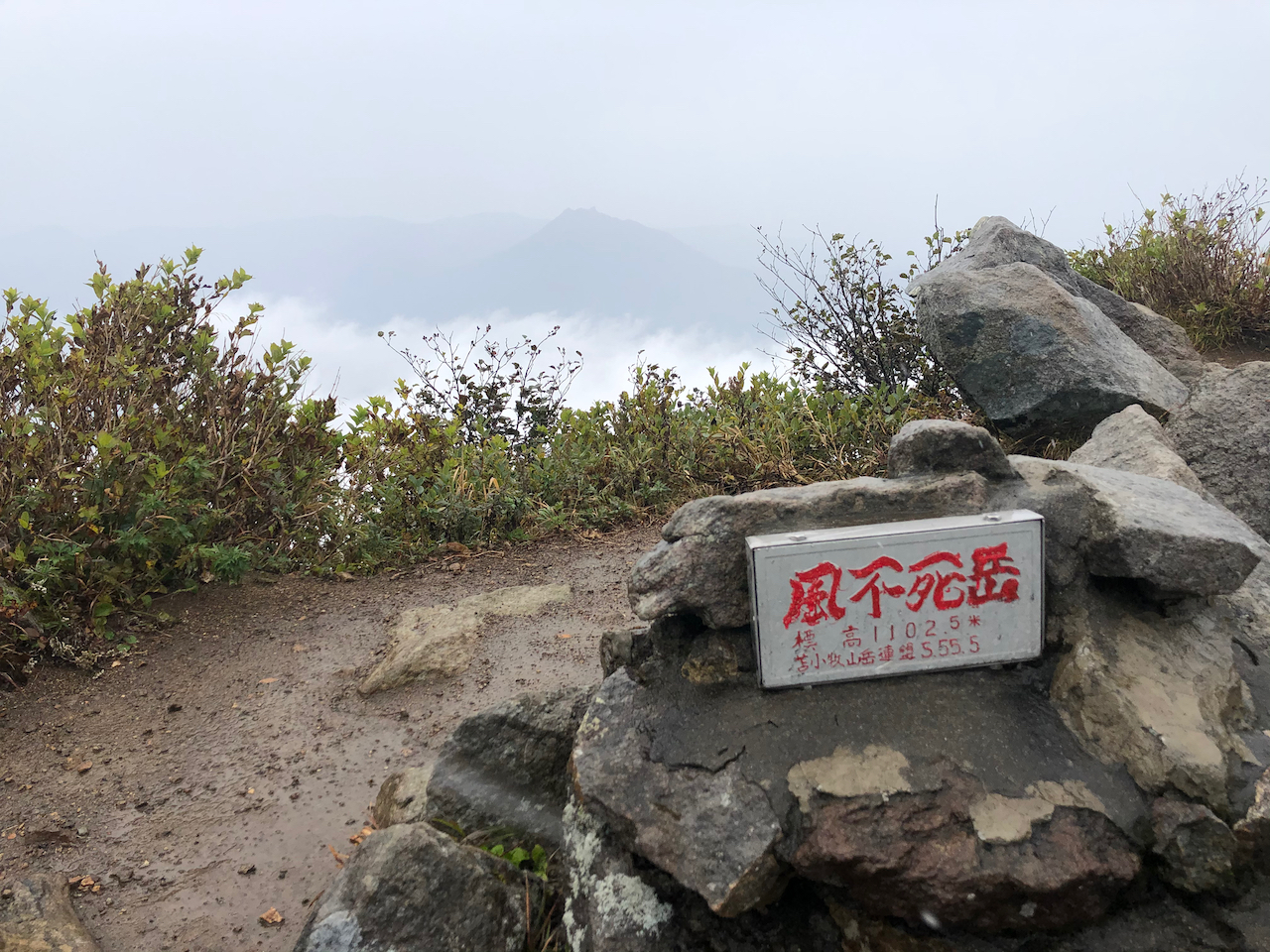
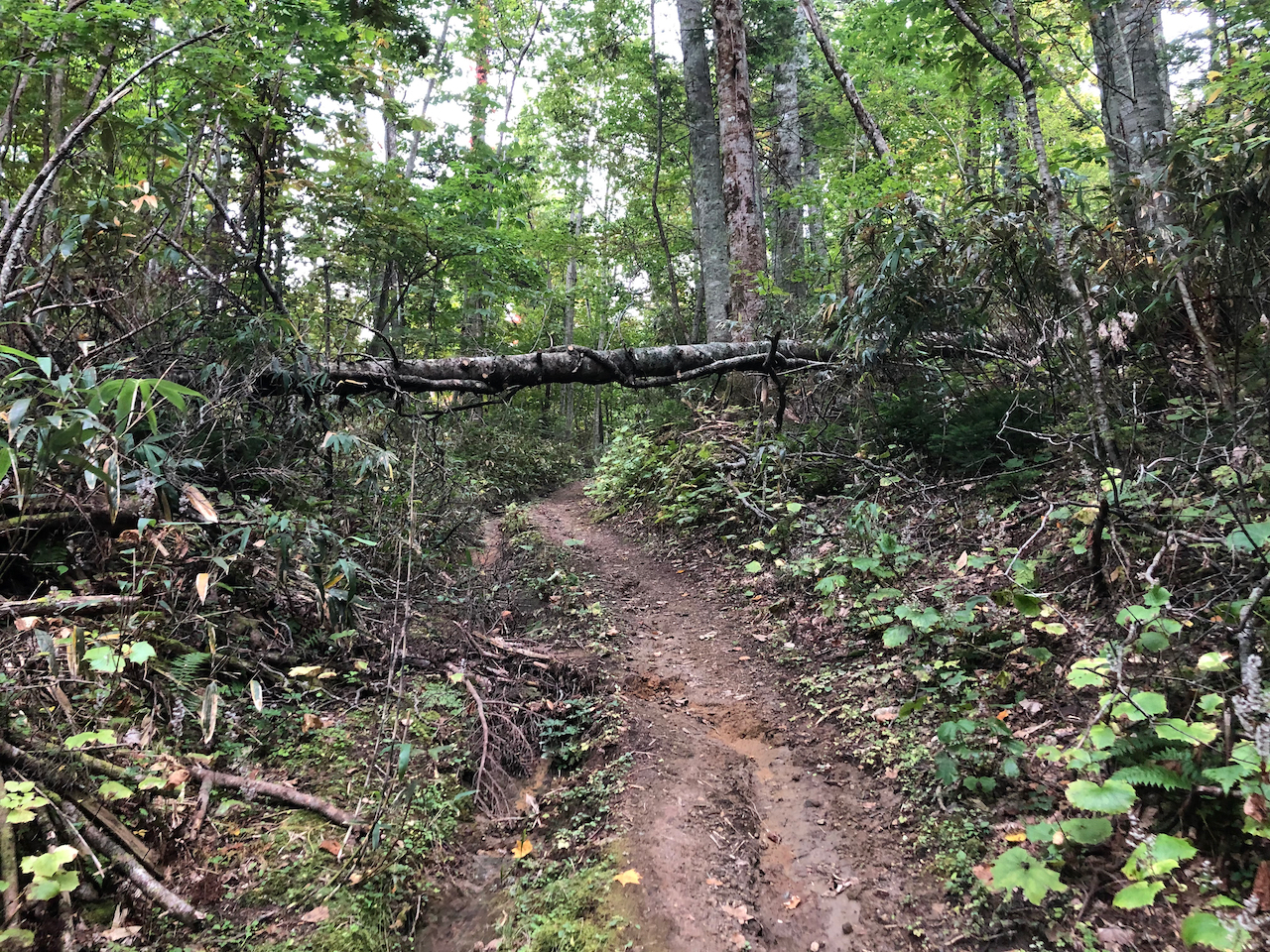
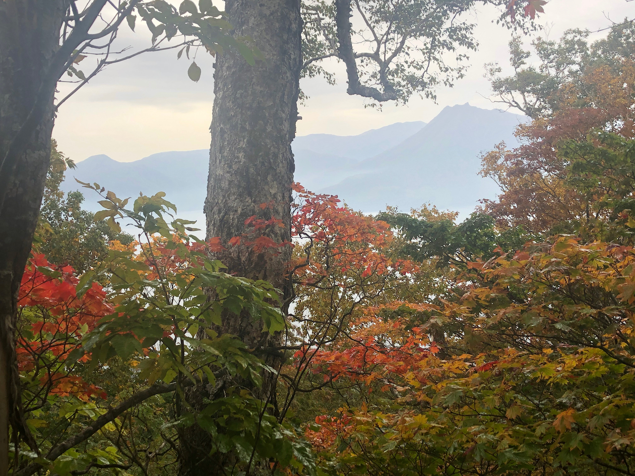
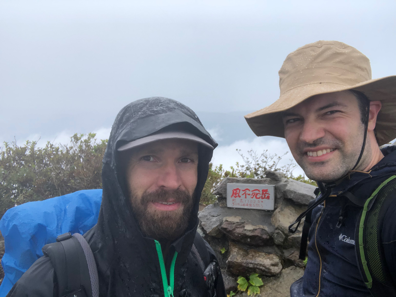
Der Fuppushi-dake 風不死岳 ist ein mittelhoher Vulkan gelegen am Shikotsu See 支笏湖 naehe der Stadt Chitose auf der noerdlichsten Insel Japans: Hokkaido. Der Berg ist mit seinen 1102m nicht allzu hoch und die Besteigung dauert auch nicht allzu lang. Der Pfad beginnt entlang einer Strasse, daher ist man mit Auto sicherlich am Besten beraten, wenn man den Berg besteigen moechte. Oben angekommen, kann man bei gutem Wetter eine Sicht auf den Shikotsu See und auch die umliegenden Berge wie den Eniwa-dake 恵庭岳 oder den Tarumae-san 樽前山 geniessen. Uns hat leider der Regen ueberrascht beim Anstieg so dass man rein gar nichts gesehen hat.
Uebrigens: Der Name Fuppushi (bzw fupp-ushi) kommt aus der Ainu Sprache und heisst uebersetzt soviel wie der Berg mit den vielen Sachalin-Tannen.